
Fil:C74135s1 Ant.Map Cape Burks.jpg
Storleik på førehandsvising: 792 × 600 pikslar. Andre oppløysingar: 317 × 240 pikslar | 634 × 480 pikslar | 1 014 × 768 pikslar | 1 280 × 970 pikslar | 2 560 × 1 939 pikslar | 4 467 × 3 384 pikslar.
Opphavleg fil (4 467 × 3 384 pikslar, filstorleik: 2,51 MB, MIME-type: image/jpeg)
Følgjande er henta frå filomtalen åt denne fila på Wikimedia Commons:
Skildring
| Skildring |
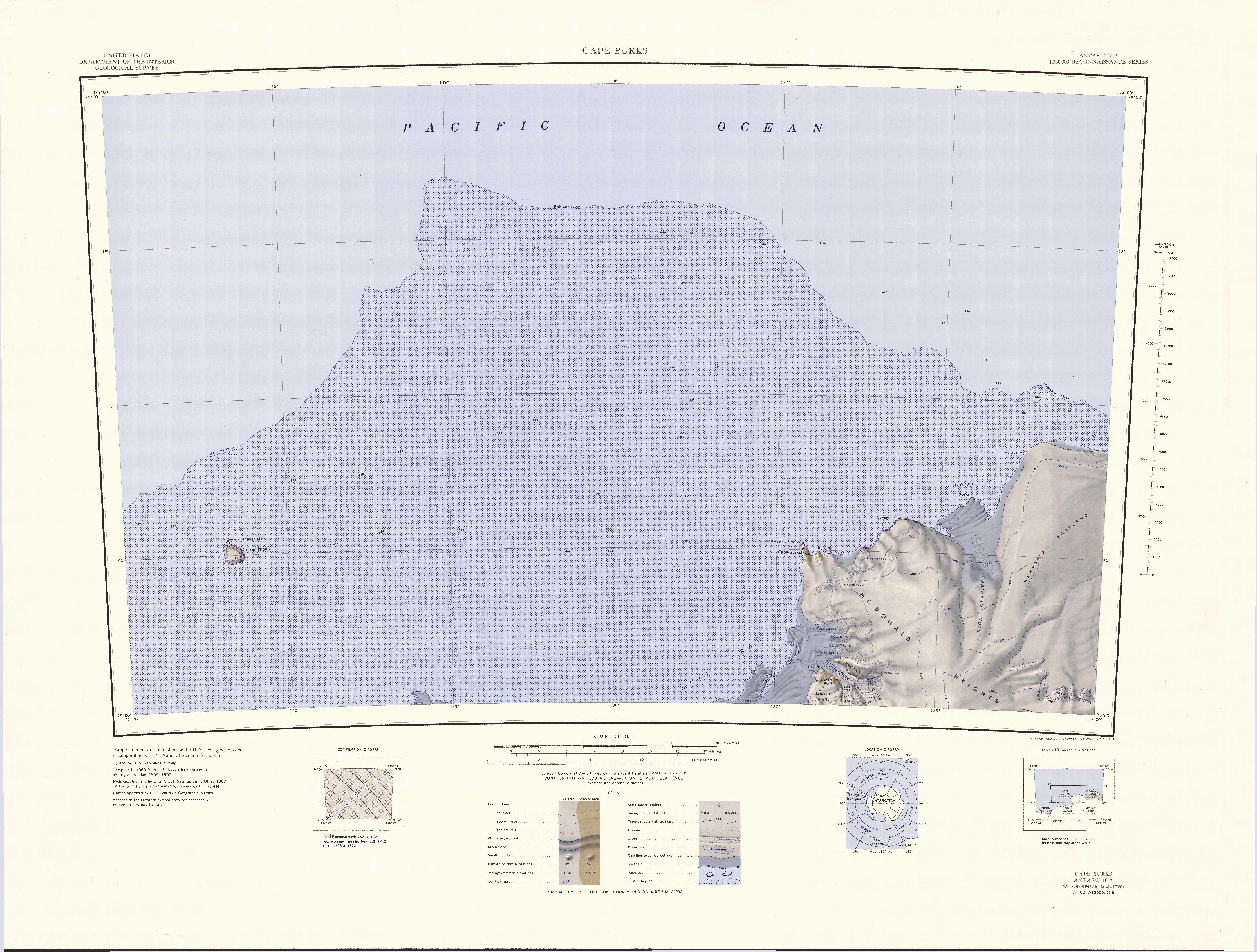
English: 1:250,000-scale topographic reconnaissance map of the Cape Burks area from 135°-141°W to 74°-75°S in Antarctica. Mapped, edited and published by the U.S. Geological Survey in cooperation with the National Science Foundation. |
|||
| Dato | ||||
| Kjelde | http://usarc.usgs.gov/drg_dload.shtml | |||
| Opphavsperson | United States Geological Survey | |||
| Løyve (Gjenbruk av denne fila) |
|
Filhistorikk
Klikk på dato/klokkeslett for å sjå fila slik ho var på det tidspunktet.
| Dato/klokkeslett | Miniatyrbilete | Oppløysing | Brukar | Kommentar | |
|---|---|---|---|---|---|
| gjeldande | 3. april 2005 kl. 19:09 | | 4 467 × 3 384 (2,51 MB) | Achim Raschka | Map of Antarctica by the United States Antarctic Ressource Center of the US Geological Society. {{PD-US}} Copyrights and Trademarks USGS-authored or produced data and information are in the public domain. While the content of most USGS web pages is in th |
Filbruk
Den følgjande sida bruker denne fila:
Global filbruk
Desse andre wikiane nyttar fila:
- Bruk på ceb.wikipedia.org
- Bruk på de.wikipedia.org
- Bruk på en.wikipedia.org
- Bruk på fr.wikipedia.org
- Bruk på he.wikipedia.org
- Bruk på it.wikipedia.org
- Bruk på pl.wikipedia.org
- Bruk på www.wikidata.org
- Bruk på zh.wikipedia.org