
Fil:HaverhillRaid1708.png
Storleik på førehandsvising: 493 × 599 pikslar. Andre oppløysingar: 197 × 240 pikslar | 395 × 480 pikslar | 948 × 1 152 pikslar.
Opphavleg fil (948 × 1 152 pikslar, filstorleik: 2,21 MB, MIME-type: image/png)
Følgjande er henta frå filomtalen åt denne fila på Wikimedia Commons:
Skildring
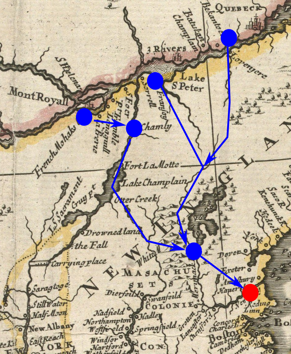
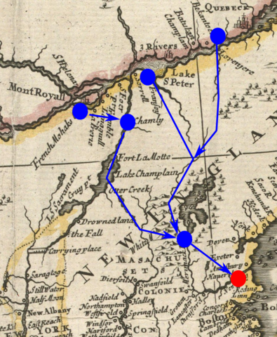
| Skildring | Detail from a 1719 map, annotated to show the routes taken (or expected to be taken) by French and Indian forces that raided Haverhill, Massachusetts in 1708. Haverhill is marked in red; the routes of the French and Indians, and their rendezvous and starting points, are marked in blue. | ||||||||||||||||
| Dato | Base map published 1719 | ||||||||||||||||
| Kjelde | From the Boston Public Library digital map collection: http://maps.bpl.org/details_13096/ | ||||||||||||||||
| Opphavsperson |
|
||||||||||||||||
Lisensiering:
The annotations are not sufficiently creative to merit copyright protection. The base image is:
This media file is in the public domain in the United States. This applies to U.S. works where the copyright has expired, often because its first publication occurred prior to January 1, 1929, and if not then due to lack of notice or renewal. See this page for further explanation.
|
 | |
 |
This image might not be in the public domain outside of the United States; this especially applies in the countries and areas that do not apply the rule of the shorter term for US works, such as Canada, Mainland China (not Hong Kong or Macao), Germany, Mexico, and Switzerland. The creator and year of publication are essential information and must be provided. See Wikipedia:Public domain and Wikipedia:Copyrights for more details.
|
Filhistorikk
Klikk på dato/klokkeslett for å sjå fila slik ho var på det tidspunktet.
| Dato/klokkeslett | Miniatyrbilete | Oppløysing | Brukar | Kommentar | |
|---|---|---|---|---|---|
| gjeldande | 2. februar 2011 kl. 15:53 | | 948 × 1 152 (2,21 MB) | Magicpiano | {{Information |Description=Detail from a 1719 map, annotated to show the routes taken (or expected to be taken) by French and Indian forces that raided Haverhill, Massachusetts in 1708. |Source=From the Boston Public Library digita |
Filbruk
Den følgjande sida bruker denne fila:
Global filbruk
Desse andre wikiane nyttar fila:
- Bruk på cs.wikipedia.org
- Bruk på en.wikipedia.org
- Bruk på fr.wikipedia.org
- Bruk på it.wikipedia.org
- Bruk på ja.wikipedia.org