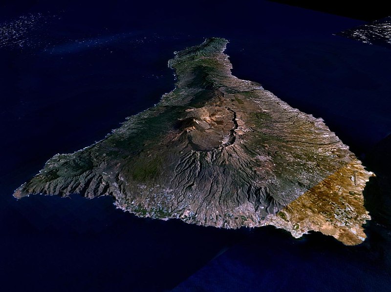
Fil:Nasa world wind - teneriffa.jpg

Storleik på førehandsvising: 800 × 599 pikslar. Andre oppløysingar: 320 × 240 pikslar | 640 × 479 pikslar | 1 024 × 766 pikslar | 1 280 × 958 pikslar.
Opphavleg fil (1 280 × 958 pikslar, filstorleik: 120 KB, MIME-type: image/jpeg)

Følgjande er henta frå filomtalen åt denne fila på Wikimedia Commons:
Filhistorikk
Klikk på dato/klokkeslett for å sjå fila slik ho var på det tidspunktet.
| Dato/klokkeslett | Miniatyrbilete | Oppløysing | Brukar | Kommentar | |
|---|---|---|---|---|---|
| gjeldande | 31. mars 2005 kl. 03:15 |  | 1 280 × 958 (120 KB) | Simplicius | {{NASA-PD}} Teneriffa from the west side. One sees Teide (3,700 meters) and the Caldera (2,000 m). To the right hand the new airport. On the left side one sees that there is more humidity and therefore vegetation at the north side of the island. |
Filbruk
Den følgjande sida bruker denne fila:
Global filbruk
Desse andre wikiane nyttar fila:
- Bruk på ar.wikipedia.org
- Bruk på be-tarask.wikipedia.org
- Bruk på cs.wikipedia.org
- Bruk på de.wikipedia.org
- Bruk på de.wikinews.org
- Bruk på de.wikivoyage.org
- Bruk på en.wiktionary.org
- Bruk på eo.wikipedia.org
- Bruk på es.wikipedia.org
- Bruk på fa.wikipedia.org
- Bruk på fi.wikipedia.org
- Bruk på frr.wikipedia.org
- Bruk på fy.wikipedia.org
- Bruk på gl.wikipedia.org
- Bruk på he.wikipedia.org
- Bruk på hu.wikipedia.org
- Bruk på incubator.wikimedia.org
- Bruk på it.wikipedia.org
- Bruk på mn.wikipedia.org
- Bruk på no.wikipedia.org
- Bruk på pl.wiktionary.org
- Bruk på ru.wikipedia.org
- Bruk på sh.wikipedia.org
- Bruk på sk.wikipedia.org
- Bruk på sw.wikipedia.org
- Bruk på tr.wikipedia.org
- Bruk på uk.wikipedia.org
- Bruk på vi.wikivoyage.org
- Bruk på zgh.wikipedia.org

