
Fil:ScotlandHighlands.png
Høgare oppløysing er ikkje tilgjengeleg.
ScotlandHighlands.png (200 × 230 pikslar, filstorleik: 4 KB, MIME-type: image/png)
Følgjande er henta frå filomtalen åt denne fila på Wikimedia Commons:
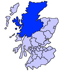
Skildring
| Skildring |
English: Highland unitary council |
| Kjelde | |
| Opphavsperson | Slightly edited version of a map drawn by Morwen |

|
Ein vektorversjon av dette biletet (SVG) er tilgjengeleg.
Han bør verta nytta i staden for dette rasterbiletet der han er betre. File:ScotlandHighlands.png → File:ScotlandHighlandCouncil.svg
For meir informasjon om vektorgrafikk, les om overgangen til SVG på commons. Det finst òg informasjon om støtta MediaWiki har for SVG-bilete. |
 |
Lisensiering:

|
Det er tillate å kopiera, distribuera og/eller modifisera dette dokumentet under retningslinene som er skildra i GNU fri dokumentasjonslisens, versjon 1.2 eller seinare utgåve utgjeven av Free Software Foundation; med alle seksjonane, utan nokon framsidetekstar og baksidetekstar. Ein kopi av lisensen er inkludert i avsnittet GNU Free Documentation License. |
| Denne fila er lisensiert under lisensen Creative Commons Namngjeving-DelPåSameVilkåra 3.0 Unported | ||
| ||
| Dette lisensieringsmerket vart lagt til denne fila som ein del av GFDL-lisensieringsoppdateringa. |
Filhistorikk
Klikk på dato/klokkeslett for å sjå fila slik ho var på det tidspunktet.
| Dato/klokkeslett | Miniatyrbilete | Oppløysing | Brukar | Kommentar | |
|---|---|---|---|---|---|
| gjeldande | 17. mai 2005 kl. 23:36 | | 200 × 230 (4 KB) | Voyager | Highland unitary council Slightly edited version of a map drawn by Morwen {{GFDL}} Category:Maps of Scottish unitary councils |
Filbruk
Den følgjande sida bruker denne fila:
Global filbruk
Desse andre wikiane nyttar fila:
- Bruk på ast.wikipedia.org
- Bruk på be.wikipedia.org
- Bruk på bg.wikipedia.org
- Bruk på br.wikipedia.org
- Bruk på cy.wikipedia.org
- Bruk på da.wikipedia.org
- Bruk på en.wikipedia.org
- Caithness
- Skye and Lochalsh
- Highland Council wards and councillors 2003 to 2007
- Highland Council wards and councillors 1999 to 2003
- Highland Council wards created in 2007
- Highland Council wards 1999 to 2007
- Highland Council wards 1995 to 1999
- Category:Scotland articles missing geocoordinate data
- Category:Highland articles missing geocoordinate data
- Wikipedia:GLAM/SLIC/Library Partners
- Highland Council Wards in 2017
- Bruk på eu.wikipedia.org
- Inverness
- Highland
- Eskoziako Lur Garaiak
- Fort William (Eskozia)
- Eilean Donan
- Lankide:Euskaldunaa
- Kyle of Lochalsh
- Ullapool
- Nairn
- Portree
- Broadford (Eskozia)
- John o' Groats
- Kingussie
- Aviemore
- Kyleakin
- Glenfinnan
- Dornoch
- Thurso (Eskozia)
- Txantiloi:Highland
- Alness
- Brora
- Dingwall
- Fortrose
- Grantown-on-Spey
- Invergordon
- Inverlochy (Highland)
- Mallaig
- Tain
- Wick (Caithness)
- Abernethy and Kincardine
- Achnahannet (Strathspey)
- Advie
- Alvie
Sjå meir global bruk av denne fila.