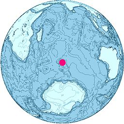
Melbourne Bluff
| Melbourne Bluff | |||
| klippe | |||
| Land | |||
|---|---|---|---|
| Stad | Heardøya | ||
| - koordinatar | 53°2′S 73°32′E / 53.033°S 73.533°E | ||
| Administrert under | Antarktistraktaten | ||
 Melbourne Bluff 53°02′00″S 73°32′00″E / 53.0333°S 73.5333°E | |||
Melbourne Bluff er ein fjellskrent, 385 moh, som ligg 2,4 km sør for Cape Bidlingmaier og som skyt fram oppom den isdekte skråningen ved nordsida av Heardøya. The feature vart kartlagt i 1948 av ANARE (Australian National Antarctic Research Expeditions) og ho fekk dette namnet av dei fordi it trends roughly aust-nordaust i general direction of Melbourne, Australia, the home headquarters på ekspedisjonen.
Kjelder[endre | endre wikiteksten]
![]() Denne artikkelen inneheld stoff som er offentleg eige frå United States Geological Survey-artikkelen «Melbourne Bluff» (innhald frå Geographic Names Information System).
Denne artikkelen inneheld stoff som er offentleg eige frå United States Geological Survey-artikkelen «Melbourne Bluff» (innhald frå Geographic Names Information System).

