
Fil:Peak District National Park UK location map.svg

Storleik på denne PNG-førehandsvisinga av denne SVG-fila: 469 × 599 pikslar. Andre oppløysingar: 188 × 240 pikslar | 376 × 480 pikslar | 601 × 768 pikslar | 802 × 1 024 pikslar | 1 604 × 2 048 pikslar | 1 022 × 1 305 pikslar.
Opphavleg fil (SVG-fil, standardoppløysing: 1 022 × 1 305 pikslar, filstorleik: 1,41 MB)
Følgjande er henta frå filomtalen åt denne fila på Wikimedia Commons:
| Skildring |
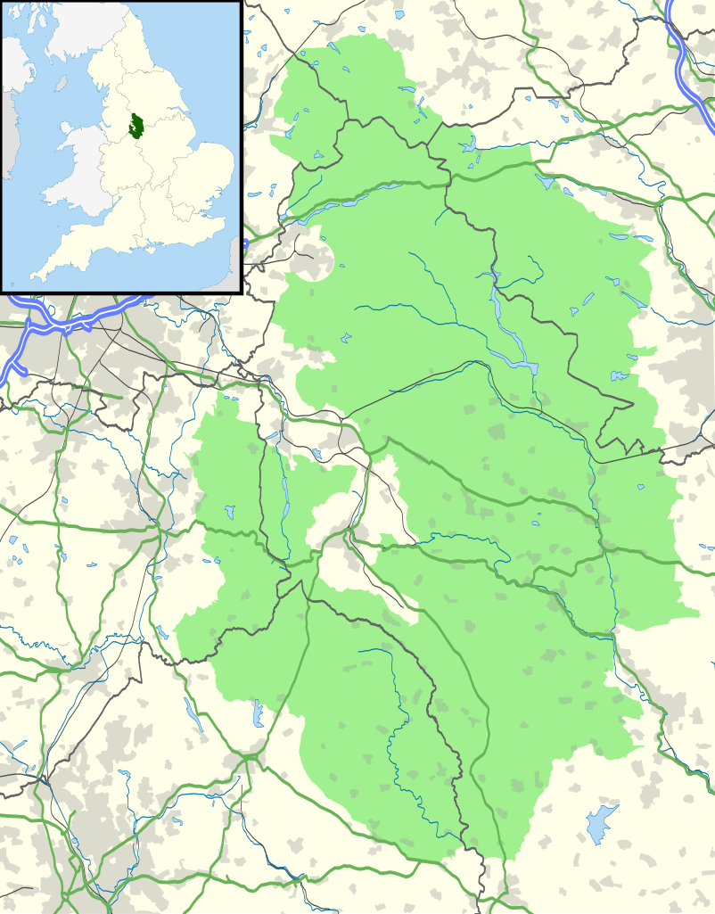
Map of the Peak District National Park, UK with the following information shown:
Equirectangular map projection on WGS 84 datum, with N/S stretched 165% Geographic limits:
|
| Dato | |
| Kjelde |
Office of National Statistics Geography
|
| Opphavsperson | Nilfanion, created using Ordnance Survey data |
| Løyve (Gjenbruk av denne fila) |
Denne fila er lisensiert under lisensen Creative Commons Namngjeving-DelPåSameVilkåra 3.0 Unported Namngjeving: Contains Ordnance Survey data © Crown copyright and database right
|
Filhistorikk
Klikk på dato/klokkeslett for å sjå fila slik ho var på det tidspunktet.
| Dato/klokkeslett | Miniatyrbilete | Oppløysing | Brukar | Kommentar | |
|---|---|---|---|---|---|
| gjeldande | 29. oktober 2010 kl. 23:37 | | 1 022 × 1 305 (1,41 MB) | Nilfanion | {{Information |Description=Map of the Peak District National Park, UK with the following information shown: *National Park boundary *Administrative borders *Coastline, lakes and rivers *Roads and railways *Urban areas Equirectangular |
Filbruk
Den følgjande sida bruker denne fila:
Global filbruk
Desse andre wikiane nyttar fila:
- Bruk på da.wikipedia.org
- Bruk på en.wikipedia.org
- Bruk på fr.wikipedia.org
- Bruk på he.wikipedia.org
- Bruk på is.wikipedia.org
- Bruk på it.wikipedia.org
- Bruk på nl.wikipedia.org
- Bruk på ru.wikipedia.org
- Bruk på simple.wikipedia.org
- Bruk på sl.wikipedia.org
- Bruk på vi.wikipedia.org
- Bruk på zh.wikipedia.org