Boyd Ridge
| Boyd Ridge | |||
| rygg | |||
| Land | |||
|---|---|---|---|
| Fjellkjede | Crary Mountains | ||
| Stad | Marie Byrd Land | ||
| - koordinatar | 76°57′S 116°57′W / 76.950°S 116.950°W | ||
| Administrert under | Antarktistraktaten | ||
 Boyd Ridge 76°57′S 116°57′W / 76.95°S 116.95°W | |||
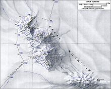
Boyd Ridge er ein isdekt rygg, 22 nautiske mil lang, som strekkjer seg frå aust til vest og dannar sørenden av Crary Mountains i Marie Byrd Land. Han er skild frå hovudtoppane i gruppa av Campbell Valley. Han vart kartlagt av US Geological Survey frå landmålingar og frå flyfoto tekne av U.S. Navy i 1959–66, og vart namngjeven av Advisory Committee on Antarctic Names etter John C. Boyd, ein biolog i US Antarctic Research Program ved McMurdo-basen sesongane 1965–66 og 1966–67.[1]
Kjelder[endre | endre wikiteksten]
- ↑ «Boyd Ridge». Geographic Names Information System. United States Geological Survey, United States Department of the Interior. Henta 20. mars 2013.
![]() Denne artikkelen inneheld stoff som er offentleg eige frå United States Geological Survey-artikkelen «Boyd Ridge» (innhald frå Geographic Names Information System).
Denne artikkelen inneheld stoff som er offentleg eige frå United States Geological Survey-artikkelen «Boyd Ridge» (innhald frå Geographic Names Information System).


