
Fil:C71188s5 Ant.Map Cape Adare.jpg
Storleik på førehandsvising: 557 × 599 pikslar. Andre oppløysingar: 223 × 240 pikslar | 446 × 480 pikslar | 714 × 768 pikslar | 952 × 1 024 pikslar | 1 903 × 2 048 pikslar | 2 877 × 3 096 pikslar.
Opphavleg fil (2 877 × 3 096 pikslar, filstorleik: 1,53 MB, MIME-type: image/jpeg)
Følgjande er henta frå filomtalen åt denne fila på Wikimedia Commons:
Skildring
| Skildring |
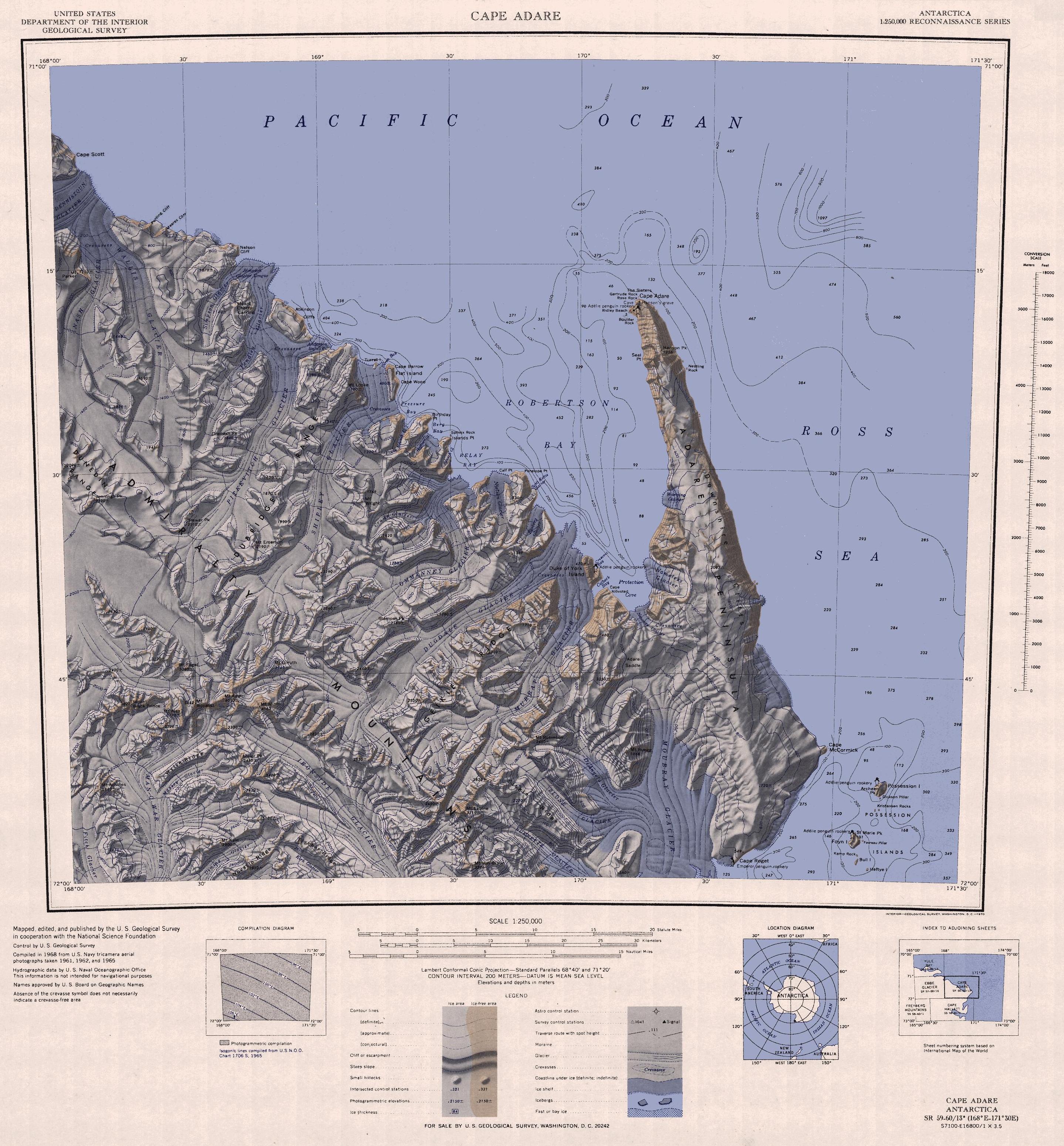
English: 1:250,000-scale topographic reconnaissance map of the Cape Adare region in Antarctica (168°E - 171°30'E, 71°S - 72°S). Mapped, edited and published by the U.S. Geological Survey in cooperation with the National Science Foundation. |
|||
| Dato | ||||
| Kjelde | http://usarc.usgs.gov/drg_dload.shtml | |||
| Opphavsperson | United States Geological Survey | |||
| Løyve (Gjenbruk av denne fila) |
|
|||
| Andre versjonar |
Derivative works of this file: |
Filhistorikk
Klikk på dato/klokkeslett for å sjå fila slik ho var på det tidspunktet.
| Dato/klokkeslett | Miniatyrbilete | Oppløysing | Brukar | Kommentar | |
|---|---|---|---|---|---|
| gjeldande | 26. november 2015 kl. 14:47 | | 2 877 × 3 096 (1,53 MB) | ValeriySh | Обрізка зайвого поля |
| 3. april 2005 kl. 18:43 |  | 3 506 × 3 260 (1,67 MB) | Achim Raschka | Map of Antarctica by the United States Antarctic Ressource Center of the US Geological Society. {{PD-US}} Copyrights and Trademarks USGS-authored or produced data and information are in the public domain. While the content of most USGS web pages is in th |
Filbruk
Det finst ikkje noka side som bruker denne fila.
Global filbruk
Desse andre wikiane nyttar fila:
- Bruk på ar.wikipedia.org
- Bruk på ast.wikipedia.org
- Bruk på az.wikipedia.org
- Bruk på be.wikipedia.org
- Bruk på bg.wikipedia.org
- Bruk på ceb.wikipedia.org
- Bruk på de.wikipedia.org
- Bruk på el.wikipedia.org
- Bruk på en.wikipedia.org
- Bruk på eo.wikipedia.org
- Bruk på es.wikipedia.org
- Bruk på fr.wikipedia.org
- Bruk på he.wikipedia.org
- Bruk på id.wikipedia.org
- Bruk på it.wikipedia.org
Sjå meir global bruk av denne fila.