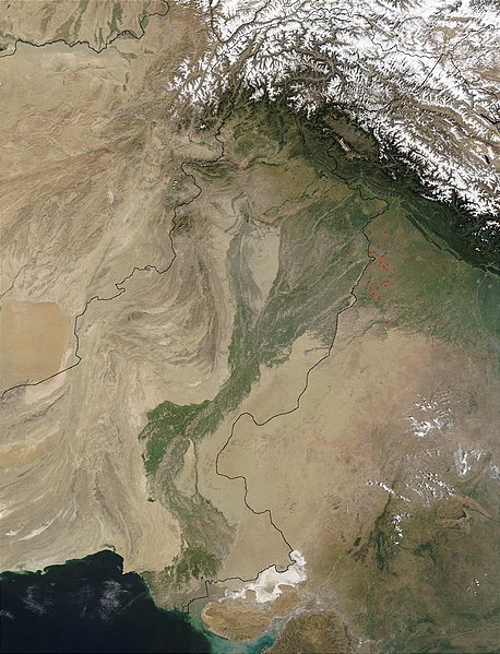
Fil:Indus.A2002274.0610.1km.jpg

Storleik på førehandsvising: 458 × 599 pikslar. Andre oppløysingar: 183 × 240 pikslar | 367 × 480 pikslar | 587 × 768 pikslar | 783 × 1 024 pikslar | 1 300 × 1 700 pikslar.
Opphavleg fil (1 300 × 1 700 pikslar, filstorleik: 480 KB, MIME-type: image/jpeg)

Følgjande er henta frå filomtalen åt denne fila på Wikimedia Commons:
Filhistorikk
Klikk på dato/klokkeslett for å sjå fila slik ho var på det tidspunktet.
| Dato/klokkeslett | Miniatyrbilete | Oppløysing | Brukar | Kommentar | |
|---|---|---|---|---|---|
| gjeldande | 28. mars 2008 kl. 15:03 |  | 1 300 × 1 700 (480 KB) | File Upload Bot (Magnus Manske) | {{BotMoveToCommons|en.wikipedia}} {{Information |Description={{en|en:Satellite image of the en:Indus River basin. Red dots indicate fires. International boundaries are superimposed; the boundary through en:Jammu and Kashmir reflects the [[ |
Filbruk
Den følgjande sida bruker denne fila:
Global filbruk
Desse andre wikiane nyttar fila:
- Bruk på af.wikipedia.org
- Bruk på ar.wikipedia.org
- Bruk på arz.wikipedia.org
- Bruk på ast.wikipedia.org
- Bruk på as.wikipedia.org
- Bruk på azb.wikipedia.org
- Bruk på az.wikipedia.org
- Bruk på ba.wikipedia.org
- Bruk på be-tarask.wikipedia.org
- Bruk på bh.wikipedia.org
- Bruk på bn.wikipedia.org
- Bruk på bo.wikipedia.org
- Bruk på br.wikipedia.org
- Bruk på bxr.wikipedia.org
- Bruk på ca.wikipedia.org
- Bruk på ceb.wikipedia.org
- Bruk på ce.wikipedia.org
- Bruk på ckb.wikipedia.org
- Bruk på cy.wikipedia.org
- Bruk på da.wikipedia.org
- Bruk på en.wikipedia.org
- Bruk på eo.wikipedia.org
- Bruk på es.wikipedia.org
- Bruk på fa.wikipedia.org
- Bruk på fiu-vro.wikipedia.org
- Bruk på gd.wikipedia.org
- Bruk på gl.wikipedia.org
- Bruk på hi.wikipedia.org
- Bruk på hy.wikipedia.org
- Bruk på ia.wikipedia.org
- Bruk på id.wikipedia.org
- Bruk på ilo.wikipedia.org
- Bruk på incubator.wikimedia.org
- Bruk på is.wikipedia.org
- Bruk på it.wikipedia.org
Sjå meir global bruk av denne fila.


