
Fil:Island of Ireland location map Galway.svg

Storleik på denne PNG-førehandsvisinga av denne SVG-fila: 481 × 599 pikslar. Andre oppløysingar: 192 × 240 pikslar | 385 × 480 pikslar | 616 × 768 pikslar | 822 × 1 024 pikslar | 1 643 × 2 048 pikslar | 1 450 × 1 807 pikslar.
Opphavleg fil (SVG-fil, standardoppløysing: 1 450 × 1 807 pikslar, filstorleik: 642 KB)
Følgjande er henta frå filomtalen åt denne fila på Wikimedia Commons:
| Skildring |
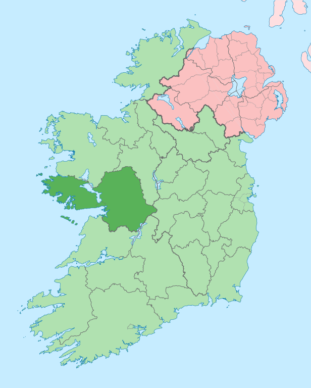
English: The island of Ireland, showing international border between Ireland and Northern Ireland, traditional provinces, traditional counties, and local authority areas in Ireland and Northern Ireland. |
| Dato | (UTC) |
| Kjelde | |
| Opphavsperson |
|
| This is a retouched picture, which means that it has been digitally altered from its original version. Modifications: Coloured in regions with county of article highlighted. The original can be viewed here: Island of Ireland location map.svg:
|
Eg, opphavsrettshaldaren til verket, publiserer det hermed under denne lisensen:
Denne fila er lisensiert under lisensen Creative Commons Namngjeving-DelPåSameVilkåra 3.0 Unported
- Du står fritt til å:
- til å dela – til å kopiera, distibuera og overføra arbeidet
- til å blanda – til å endra verket
- På desse vilkåra:
- namngjeving – Du lyt godskriva verket på den måten som opphavpersonen eller lisensgjevaren har oppgjeve (men ikkje på ein slik måte at det kan verka som om dei går god for deg eller måten du nyttar verket på).
- del på same vilkåra – Om du remiksar, omarbeider, eller på annan måte byggjer på dette verket, kan du berre distribuera resultatet under den same eller ein samsvarande lisens som denne.
Opphavleg opplastingslogg
This image is a derivative work of the following images:
- File:Island_of_Ireland_location_map.svg licensed with Cc-by-sa-3.0
- 2010-03-06T20:43:33Z Rannpháirtí anaithnid 1450x1807 (679207 Bytes) Fix incorrectly coloured isands.
- 2010-03-03T22:19:29Z Rannpháirtí anaithnid 1450x1807 (679744 Bytes) {{Information |Description={{de|Positionskarte von [[:de:Irland|Irland]]}} Quadratische Plattkarte, N-S-Streckung 170 %. Geographische Begrenzung der Karte: * N: 55.6° N * S: 51.2° N * W: 11.0° W * O: 5.0° W {{en|Location
Uploaded with derivativeFX
Filhistorikk
Klikk på dato/klokkeslett for å sjå fila slik ho var på det tidspunktet.
| Dato/klokkeslett | Miniatyrbilete | Oppløysing | Brukar | Kommentar | |
|---|---|---|---|---|---|
| gjeldande | 28. juni 2020 kl. 16:00 | | 1 450 × 1 807 (642 KB) | Chipmunkdavis | Per the Local Government Reform Act 2014, joining both Tipperarys and both Waterfords (and removing Limerick City code). Colouring in islands, cleaning up and grouping code to remove stray objects and show Galway and Lough Ree. |
| 19. juli 2010 kl. 02:44 |  | 1 450 × 1 807 (816 KB) | Mabuska | {{Information |Description={{en|The island of Ireland, showing international border between Northern Ireland and Republic of Ireland, traditional provinces, traditional counties, and local authority areas in the Republic of Ireland and Northern Ireland.}} |
Filbruk
Den følgjande sida bruker denne fila:
Global filbruk
Desse andre wikiane nyttar fila:
- Bruk på ar.wikipedia.org
- Bruk på ast.wikipedia.org
- Bruk på bg.wikipedia.org
- Bruk på ca.wikipedia.org
- Comtat de Galway
- Galway
- Athenry
- An Spidéal
- Tuam
- Kinvara
- Plantilla:Comtat Galway
- Ballinasloe
- Gort
- Loughrea
- Baile na hAbhann
- Casla (Irlanda)
- Béal an Daingin
- Camus (Galway)
- An Cheathrú Rua
- Baile an Chláir
- Bearna
- Ros Muc
- An Fhairche
- Corr na Móna
- Leitir Móir
- Leitir Mealláin
- Maigh Cuilinn
- Ros an Mhíl
- Indreabhán
- Cill Chiaráin
- Cill Rónáin
- Na Forbacha
- Clifden
- New Inn (Galway)
- Aughrim (Galway)
- Baile an Mhuilinn (Galway)
- Bruk på ceb.wikipedia.org
- Bruk på cs.wikipedia.org
- Bruk på en.wikipedia.org
Sjå meir global bruk av denne fila.