
Fil:Karte Oscarsborg.png

Storleik på førehandsvising: 471 × 600 pikslar. Andre oppløysingar: 188 × 240 pikslar | 570 × 726 pikslar.
Opphavleg fil (570 × 726 pikslar, filstorleik: 79 KB, MIME-type: image/png)
Følgjande er henta frå filomtalen åt denne fila på Wikimedia Commons:

|
Dette map biletet bør verta oppretta på nytt som vektorgrafikk i SVG-format. Dette har fleire føremoner; sjå Commons:Media for cleanup for meir informasjon. Om ein SVG-versjon av dette biletet alt er tilgjengeleg, gjer vel og last han opp. Ettar å ha lasta opp ei SVG-fil, erstatt denne malen med {{vector version available|nytt biletnamn.svg}}.
|
Skildring
Lisensiering:

|
Det er tillate å kopiera, distribuera og/eller modifisera dette dokumentet under retningslinene som er skildra i GNU fri dokumentasjonslisens, versjon 1.2 eller seinare utgåve utgjeven av Free Software Foundation; med alle seksjonane, utan nokon framsidetekstar og baksidetekstar. Ein kopi av lisensen er inkludert i avsnittet GNU Free Documentation License. |
| Denne fila er lisensiert under lisensen Creative Commons Namngjeving-DelPåSameVilkåra 3.0 Unported | ||
| ||
| Dette lisensieringsmerket vart lagt til denne fila som ein del av GFDL-lisensieringsoppdateringa. |
Filhistorikk
Klikk på dato/klokkeslett for å sjå fila slik ho var på det tidspunktet.
| Dato/klokkeslett | Miniatyrbilete | Oppløysing | Brukar | Kommentar | |
|---|---|---|---|---|---|
| gjeldande | 9. juni 2015 kl. 02:29 | | 570 × 726 (79 KB) | Cmdrjameson | Compressed with pngout. Reduced by 94kB (54% decrease). |
| 7. april 2005 kl. 21:23 |  | 570 × 726 (173 KB) | Markus Schweiss | Map refined with help of a norwegian wikipedian and his nautical chart of this area, sent by E-Mail to me {{GFDL}} | |
| 4. april 2005 kl. 06:32 |  | 570 × 726 (173 KB) | Markus Schweiss | Map correction {{GFDL}} | |
| 3. april 2005 kl. 22:48 |  | 570 × 726 (173 KB) | Markus Schweiss | Correction of the map, {{GFDL}} | |
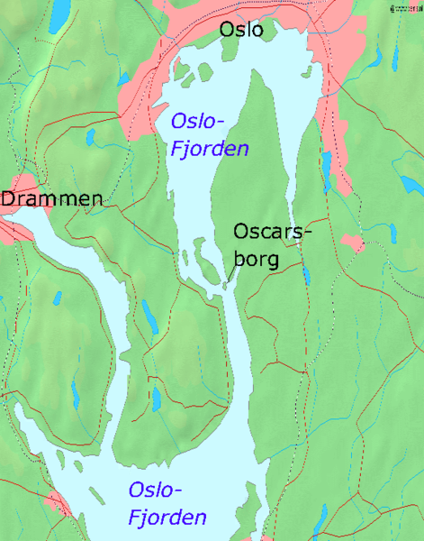
| 3. april 2005 kl. 22:24 |  | 570 × 726 (173 KB) | Markus Schweiss | Map of the Oslofjord and the fortress of Oscarsborg, Source of Map: [http://www2.demis.nl/mapserver/mapper.asp] {{GFDL}} Category:Norwegian history |
Filbruk
Den følgjande sida bruker denne fila:
Global filbruk
Desse andre wikiane nyttar fila:
- Bruk på azb.wikipedia.org
- Bruk på bg.wikipedia.org
- Bruk på da.wikipedia.org
- Bruk på de.wikipedia.org
- Bruk på en.wikipedia.org
- Bruk på fr.wikipedia.org
- Bruk på hr.wikipedia.org
- Bruk på hu.wikipedia.org
- Bruk på id.wikipedia.org
- Bruk på it.wikipedia.org
- Bruk på ja.wikipedia.org
- Bruk på mk.wikipedia.org
- Bruk på nl.wikipedia.org
- Bruk på no.wikipedia.org
- Bruk på pl.wikipedia.org
- Bruk på sr.wikipedia.org
- Bruk på sv.wikipedia.org
- Bruk på vi.wikipedia.org
- Bruk på zh-yue.wikipedia.org
- Bruk på zh.wikipedia.org