
Fil:Kokuritsu Yoyogi Kyōgijō 1.jpg
Opphavleg fil (4 412 × 2 941 pikslar, filstorleik: 8,81 MB, MIME-type: image/jpeg)
Følgjande er henta frå filomtalen åt denne fila på Wikimedia Commons:
Skildring
| Skildring |
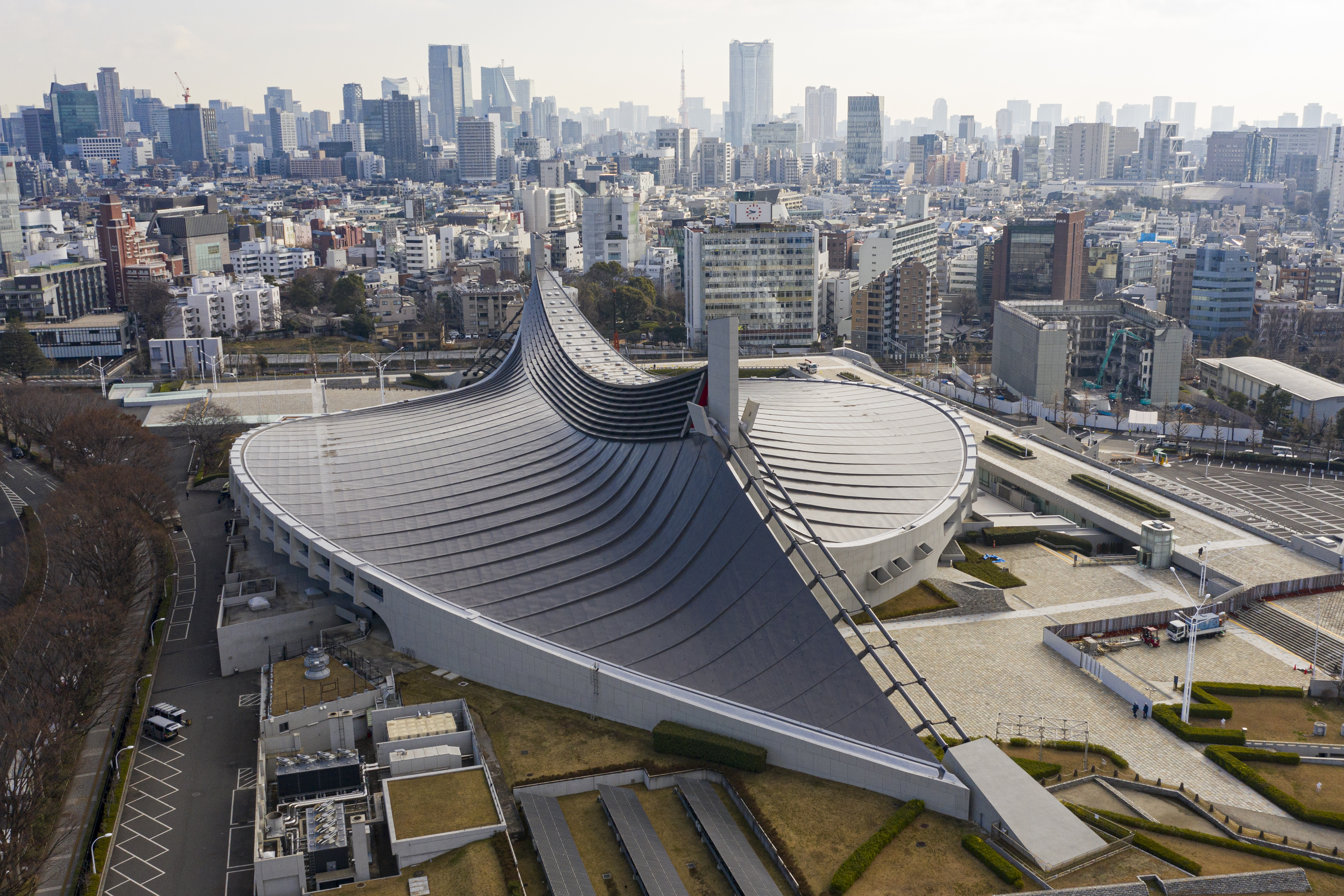
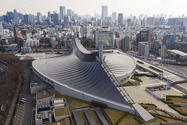
English: Aerial view of Kokuritsu Yoyogi Kyōgijō, Tokyo, Japan |
|||||||||||||||||
| Dato | ||||||||||||||||||
| Kjelde | Eige arbeid | |||||||||||||||||
| Opphavsperson |
|
|||||||||||||||||
| Løyve (Gjenbruk av denne fila) |
I published this file as author under the Creative Commons License CC-by-SA-3.0.. This means that a ‘free use outside Wikimedia’s projects’ is only possible under the following conditions:
I would be very grateful if you could send me a specimen copy of the photo/map or the details of the website where the photo/map will be used. Basically, all my photos and maps can be licensed under the conditions of the Mittelstandsgemeinschaft Foto-Marketing (MFM). Please send an email to lizenz AT arne-mueseler.de if you
Arne Müseler / www.arne-mueseler.com, opphavspersonen til dette verket, har publisert eller publiserer det hermed under følgjande lisens: Denne filen er lisensiert under lisensen Creative Commons Navngivelse-DelPåSammeVilkår 3.0 Tyskland. Namngjeving: Arne Müseler / www.arne-mueseler.com
 |
|||||||||||||||||

| Kameraposisjon | | Dette og andre bilete på denne posisjonen i: OpenStreetMap |
|---|

|
This image has been assessed under the valued image criteria and is considered the most valued image on Commons within the scope: Aerial view of Yoyogi National Gymnasium. You can see its nomination here. |
Filhistorikk
Klikk på dato/klokkeslett for å sjå fila slik ho var på det tidspunktet.
| Dato/klokkeslett | Miniatyrbilete | Oppløysing | Brukar | Kommentar | |
|---|---|---|---|---|---|
| gjeldande | 15. januar 2020 kl. 17:29 | | 4 412 × 2 941 (8,81 MB) | Arne Müseler | {{Information |description={{en|1=Aerial view of Kokuritsu Yoyogi Kyōgijō, Tokyo, Japan}} |source={{own}} |Author={{User:Arne mueseler/Autor}} |Permission={{Template:ArneMueselerCredit}} |other_versions= }} {{Location|35.667669|139.700174}} Category:Kokuritsu Yoyogi Kyōgijō Category:Japan - Photographs by Arne Müseler |
Filbruk
Dei følgjande 2 sidene bruker denne fila:
Global filbruk
Desse andre wikiane nyttar fila:
- Bruk på ar.wikipedia.org
- Bruk på bg.wikipedia.org
- Bruk på ca.wikipedia.org
- Bruk på cs.wikipedia.org
- Bruk på da.wikipedia.org
- Bruk på de.wikipedia.org
- Bruk på de.wikivoyage.org
- Bruk på en.wikipedia.org
- Tokyo
- Kenzō Tange
- 1964 Summer Olympics
- Shibuya
- Modern architecture
- Japanese architecture
- 2020 Summer Olympics
- The Yellow Monkey
- Yoyogi National Gymnasium
- Expressionist architecture
- Swimming at the 1964 Summer Olympics
- Architecture of Tokyo
- List of Olympic venues in swimming
- Suspended structure
- Miss International 2023
- 2023 FIVB Volleyball Men's Olympic Qualification Tournaments
- 2023 FIVB Volleyball Women's Olympic Qualification Tournaments
- User:Triila73/sandbox/What should Miss International 2023 really look like?
- Bruk på eo.wikipedia.org
- Bruk på es.wikipedia.org
- Bruk på eu.wikipedia.org
- Bruk på fa.wikipedia.org
- Bruk på fy.wikipedia.org
- Bruk på gl.wikipedia.org
- Bruk på he.wikipedia.org
- Bruk på hy.wikipedia.org
- Bruk på id.wikipedia.org
- Bruk på incubator.wikimedia.org
Sjå meir global bruk av denne fila.