
Fil:Modiin1870s.jpg
Storleik på førehandsvising: 627 × 599 pikslar. Andre oppløysingar: 251 × 240 pikslar | 502 × 480 pikslar | 803 × 768 pikslar | 1 094 × 1 046 pikslar.
Opphavleg fil (1 094 × 1 046 pikslar, filstorleik: 245 KB, MIME-type: image/jpeg)
Følgjande er henta frå filomtalen åt denne fila på Wikimedia Commons:
Skildring
| Skildring |
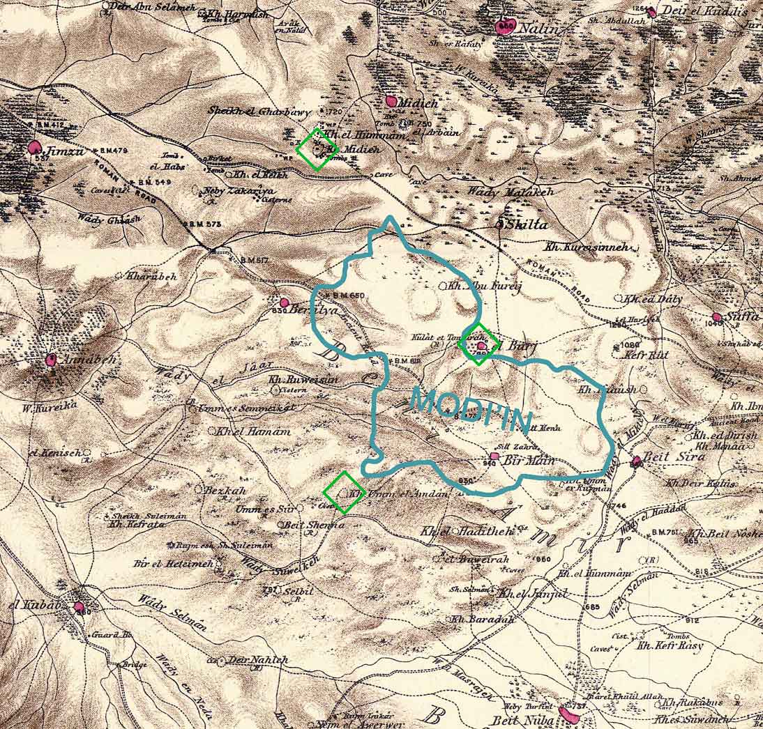
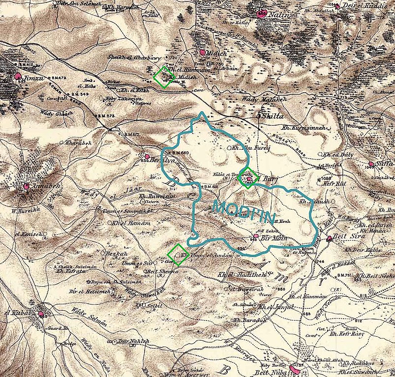
Combination of portions of two maps produced by the Survey of Western Palestine, first published in 1880 by the Committee of the Palestine Exploration Fund. The editor, Walter Besant, died in 1901. The blue shape gives the approximate boundaries of the build-up area of Modi'in in 2006 (Google Earth). The green diamonds show three scientific theories regarding the location of the ancient city of Modi'in. There are other popular theories. Produced by Zero0000 using Photoshop 7.0. |
| Dato | 28. januar 2007 (original upload date) |
| Kjelde | Inga maskinlesbar kjelde er oppgjeven. Frå påstandar om opphavsrett vert det rekna med at det er eige arbeid. |
| Opphavsperson | Ingen maskinlesbar opphavsperson er oppgjeven. Frå påstandar om opphavsrett vert det rekna med at Zero0000 er opphavsperson. |
Lisensiering:
| Eg, opphavsrettshaldaren til dette verket, frigjev dette verket til ålmenta. Dette gjeld over heile verda. I somme landa er dette kan henda ikkje rettsleg mogeleg. I det fall: Eg gjev kven som helst rettane til å nytta dette verket for kva som helst føremål og utan vilkår, minder vilkår er kravde etter lova. |
Filhistorikk
Klikk på dato/klokkeslett for å sjå fila slik ho var på det tidspunktet.
| Dato/klokkeslett | Miniatyrbilete | Oppløysing | Brukar | Kommentar | |
|---|---|---|---|---|---|
| gjeldande | 28. januar 2007 kl. 12:08 | | 1 094 × 1 046 (245 KB) | Zero0000 | Combination of portions of two maps produced by the Survey of Western Palestine, first published in 1880 by the Committee of the Palestine Exploration Fund. The editor, Walter Besant, died in 1901. The blue shape gives the approximate boundaries of the b |
Filbruk
Den følgjande sida bruker denne fila:
Global filbruk
Desse andre wikiane nyttar fila:
- Bruk på cs.wikipedia.org
- Bruk på el.wikipedia.org
- Bruk på en.wikipedia.org
- Bruk på he.wikipedia.org
- Bruk på id.wikipedia.org
- Bruk på no.wikipedia.org
- Bruk på pl.wikipedia.org
- Bruk på sco.wikipedia.org