Fil:Thar Desert satellite.jpg

Storleik på førehandsvising: 471 × 599 pikslar. Andre oppløysingar: 189 × 240 pikslar | 500 × 636 pikslar.
Opphavleg fil (500 × 636 pikslar, filstorleik: 329 KB, MIME-type: image/jpeg)

Følgjande er henta frå filomtalen åt denne fila på Wikimedia Commons:
Filhistorikk
Klikk på dato/klokkeslett for å sjå fila slik ho var på det tidspunktet.
| Dato/klokkeslett | Miniatyrbilete | Oppløysing | Brukar | Kommentar | |
|---|---|---|---|---|---|
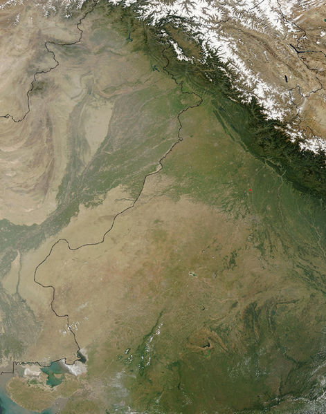
| gjeldande | 17. september 2005 kl. 16:25 |  | 500 × 636 (329 KB) | Crux | Satellite Image of Thar Desert, India/Pakistan (border line in the middle) from en:, uploaded by en:User:Tom Radulovich |
Filbruk
Den følgjande sida bruker denne fila:
Global filbruk
Desse andre wikiane nyttar fila:
- Bruk på ar.wikipedia.org
- Bruk på az.wikipedia.org
- Bruk på bg.wikipedia.org
- Bruk på bn.wikipedia.org
- Bruk på bs.wikipedia.org
- Bruk på ckb.wikipedia.org
- Bruk på de.wikipedia.org
- Bruk på en.wikipedia.org
- Bruk på eo.wikipedia.org
- Bruk på es.wikipedia.org
- Bruk på et.wikipedia.org
- Bruk på fa.wikipedia.org
- Bruk på fi.wikipedia.org
- Bruk på fr.wikipedia.org
- Bruk på he.wikipedia.org
- Bruk på hu.wikipedia.org
- Bruk på it.wikipedia.org
- Bruk på ja.wikipedia.org
- Bruk på ka.wikipedia.org
- Bruk på kk.wikipedia.org
- Bruk på kn.wikipedia.org
- Bruk på ko.wikipedia.org
- Bruk på ky.wikipedia.org
- Bruk på lfn.wikipedia.org
- Bruk på lt.wikipedia.org
- Bruk på mai.wikipedia.org
- Bruk på mg.wikipedia.org
- Bruk på mk.wikipedia.org
- Bruk på ml.wikipedia.org
- Bruk på mr.wikipedia.org
- Bruk på ms.wikipedia.org
- Bruk på ne.wikipedia.org
- Bruk på pa.wikipedia.org
- Bruk på pl.wikipedia.org
- Bruk på pnb.wikipedia.org
- Bruk på pt.wikipedia.org
Sjå meir global bruk av denne fila.


