
Fil:USGS-Mars-AmazonisPlanitia-mola.jpg

Storleik på førehandsvising: 600 × 600 pikslar. Andre oppløysingar: 240 × 240 pikslar | 480 × 480 pikslar | 776 × 776 pikslar.
Opphavleg fil (776 × 776 pikslar, filstorleik: 98 KB, MIME-type: image/jpeg)
Følgjande er henta frå filomtalen åt denne fila på Wikimedia Commons:


Skildring
| Skildring |
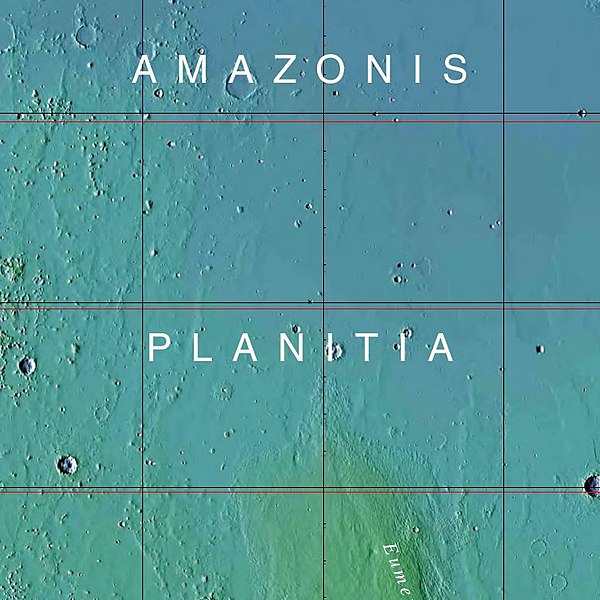
English: MOLA Topographic Map of Amazonis Quadrangle (MC-8) on the planet Mars. (cropped version - Amazonis Planitia area).
NOTE: Converted the original PDF File to a PNG File (via GIMP v2.8.4 program) - cropped/converted to JPG File (via Paint Shop Pro 6.02) - and uploaded to Wikimedia Commons. |
| Dato | |
| Kjelde | http://planetarynames.wr.usgs.gov/images/mc8_mola.pdf |
| Opphavsperson | USGS (United States Geological Survey) |
| Andre versjonar | File:USGS-Mars-MC-8-AmazonisRegion-mola.png |
Lisensiering:
This image is in the public domain in the United States because it only contains materials that originally came from the United States Geological Survey, an agency of the United States Department of the Interior. For more information, see the official USGS copyright policy.
|
Filhistorikk
Klikk på dato/klokkeslett for å sjå fila slik ho var på det tidspunktet.
| Dato/klokkeslett | Miniatyrbilete | Oppløysing | Brukar | Kommentar | |
|---|---|---|---|---|---|
| gjeldande | 23. juni 2013 kl. 15:38 | | 776 × 776 (98 KB) | Drbogdan | User created page with UploadWizard |
Filbruk
Den følgjande sida bruker denne fila:
Global filbruk
Desse andre wikiane nyttar fila:
- Bruk på ar.wikipedia.org
- Bruk på en.wikipedia.org
- Bruk på pt.wikipedia.org
- Bruk på ru.wikipedia.org
- Bruk på sv.wikipedia.org
- Bruk på uk.wikipedia.org
- Bruk på zh.wikipedia.org