
John Speed
| John Speed | |||
 | |||
| Fødd | 1551 Farndon | ||
|---|---|---|---|
| Død | 28. juli 1629 London | ||
| Nasjonalitet | Det sameinte kongeriket Storbritannia og Irland | ||
| Område | kartografi | ||
| Yrke | kartograf, historikar | ||
| Barn | John Speed | ||
John Speed (1551 eller 1552-28. juli 1629) var ein engelsk kartograf og historikar.[1][2][3] Han og Christopher Saxton er dei best kjende engelske kartmakarane frå tidleg moderne tid.[4][5][6]
Liv[endre | endre wikiteksten]
Speed var fødd i landsbyen Farndon i Cheshire som son av skreddaren John Speed. Han gjekk etterkvart inn i faren sitt yrke.[7][8][9]
Speed arbeidde i London, der han blei borgar og Merchant Taylor,[10] og blei lagt merke til av «lærde» personar.[11] Ein av desse var sir Fulke Greville, som gav han økonomisk støtte slik at han kunne via seg til forsking. I 1598 hadde han nok støtte til å gje opp manuelt arbeid og driva med forsking på fulltid.[12] Som løn for tidlegare arbeid gav dronning Elisabet han løyve til å bruka eit rom i Custom House.
Speed gifta seg med Susanna Draper i 1575 og fekk fleire barn. Ein kjenner ikkje til kor mange, men ein av dei var ein son som også heitte John Speed, og som blei ein «lærd» mann med ein doktorgrad.[13][14][15][16][17][18]
Rundt 1595 gav Speed ut eit kart av det bibelske Kanaan. I 1598 presenterte han karta sine til dronning Elisabet, og i 1611–1612 gav han ut kart over Storbritannia, moglegvis med hjelp frå sonen til å studera engelske byar.[19][20][21]
I juli 1629, 77 eller 78 år gammal, døydde Speed.[22] Han blei gravlagd ved sida av kona si i kyrkja St Giles-without-Cripplegate ved Fore Streeti London.[23][24][25] Seinare blei det sett opp eit minnesmerke til John Speed bak altaret i kyrkja.[26]
Virke[endre | endre wikiteksten]
Speed teikna opp historiske kart i 1601 og 1627 som viste invasjonane av England og Irland, mellomalderen og samtida i England. Dei ferdige versjonane av karta var fargerike og attraktive.[27][28]
Oppmuntra av William Camden byra Speed på sin Historie of Great Britaine, som kom ut i 1611.[29][30] Sjølv om han truleg hadde tilgang til historiske kjelder som seinare er gått tapt (han brukte i det minste verka til Saxton og Norden), er verket hans som historikar no rekna som underordna i høve til kartmakinga hans. Dette omfattar kart over byar der mange er den fyrste visuelle nedteikninga av byen dei viser.[31] I åra som leia opp til uttgjevinga av dette atlaset sende han brev til sir Robert Cotton for å be om hjelp til å samla dei nødvendige materiala.[32]
Speed sitt atlas The Theatre of the Empire of Great Britaine kom ut i 1611 og 1612, og omftata dei fyrste individuelle karta over fylke i England og Wales i tillegg til kart av Irland og eit generelt kart av Skottland.[33][34][35]
Dei fleste av fylkeskarta, men ikkje alle, hadde også bykart. Dei som viste Scale of Passes var stader han hadde kartlagd sjølv.I 1627, to år før han døydde, gav Speed ut Prospect of the Most Famous Parts of the World, det fyrste verdsatlas laga av ein engelskmann. Det kosta 40 shilling, slik at berre rikare kundar og bibliotek kunne kjøpa det. Fleire eksemplar har overlevd til våre dagar.[36][37]
I 1611 gav han også ut The Genealogies recorded in the Sacred Scriptures according to euery family and tribe with the line of Our Sauior Jesus Christ obserued from Adam to the Blessed Virgin Mary, ei bibelsk stamtavle som blei printa opp att fleire gonger på 1600-talet.[38] I mange år blei denne korte pamfletten bunde inn i alle utgjevingar av den engelske Bibelen. Kong James sjølv gav Speed eit patent til å få fortenesta av dette som løn for det store arbeidet sitt.[39] Han teikna også kart over Kanaløyane, Polen og Amerika.[40][41][42][43] I året han døydde blei endå ei samling kart over Storbritannia son han hadde laga året før gjeven ut.[44][45]
Galleri[endre | endre wikiteksten]
-
 Speed sitt kart over Wales frå 1610
 -
 Døme på eit insett bilde i Speed sitt kart over Wales frå 1610
 -
 Countie Pallatine of Lancaster frå 1610
 -
 Firesidrers veggkart over Kanaan frå 1595
 -
 Kart over Wilshire frå 1610 med byplan over Salisbury og eit bilde av Stonehenge
 -
 Northamptonshire, 1610
 -
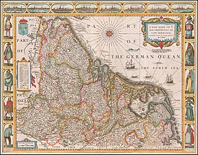 A New Mape of Ye XVII Provinces, 1626 (Nederlanda)
 -
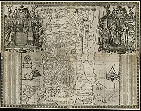
 The Kingdome of China, 1626
 -
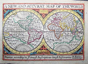 A New And Accvrat Map of the World, 1646
 -
 Jamaica, 1676
 -
 Jakob VI, avbilda i Royal Map of Scotland frå 1610
 -
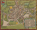
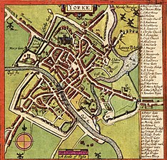 kart over York frå 1611


_1626.jpg)


.png)


Bykart[endre | endre wikiteksten]
-
 Bedforde, 1611
 -
 Dubline, 1610; gjentrykk frå 1896
 -
 Monmouth, 1610
 -
 Oxford, 1610
 -
 Redding, 1610
 -
 Bangor, 1610
 -
 Brecon, 1610
 -
 Cardiff, 1610
 -
 Montgomery, 1610
 -
 St David's ,1610
.jpg)


Verk[endre | endre wikiteksten]
- The Theatre of The Empire of Great Britaine, Presenting an exact geography of England, Scotland, and Ireland (London 1611–12).
- Theatrum Imperii Magnae Britaine, Latin Edition (London 1616).
- History of Great Britaine Under the Conquests of Romans, Saxons, Danes, and Normans, 1st Edition (London 1611), text at Umich/eebo. Second, Revised Edition (London 1623), page views at Google.
- The Genealogies recorded in the Sacred Scriptures according to euery family and tribe with the line of Our Sauior Jesus Christ obserued from Adam to the Blessed Virgin Mary (London 1611). 1636 printing bound into 1637 Robert Barker bible, page views at Google.
- A Cloud of Witnesses: and they the holy genealogies of the sacred scriptures. Confirming unto us the truth of the histories in Gods most holie word; and the humanitie of Christ Iesus 1st Edition (London 1616). Second Edition (London 1620), text at Umich/eebo.
- England, Wales, Scotland and Ireland: Described and Abridged with Ye Historic Relation of Things Worthy Memory: from a Farr Larger Voulume (London 1627) The "Farr Larger Volume" is The Theatre of The Empire of Great Britaine.
- A Prospect of the Most Famous Parts of the World (London 1627)
Kjelder[endre | endre wikiteksten]
- ↑ Baynton-Williams, Ashley. «John Speed». MapForum.Com. Arkivert frå originalen 16. mars 2019. Henta 17 September 2012.
- ↑ "Life of John Speed", The Hibernian Magazine, Or, Compendium of Entertaining Knowledge, July 1782, p. 348 (Google).
- ↑ John Speed, Nigel Nicolson (introduction), The Counties of Britain: A Tudor Atlas, Thames & Hudson (1989): ISBN 0-500-25104-5; Pavilion Books (1992): ISBN 1-85145-131-5 (pbk, 1995): ISBN 1-85793-612-4.
- ↑ «Maps by John Speed». Jonathan Potter Limited. Arkivert frå originalen 3 March 2012. Henta 17 September 2012.
- ↑ Intriguing History, "John Speed Maps Online", 2017.
- ↑ Hewitt, Rachel (2010). Map of a Nation. London: Granta Publications. s. xxvi. ISBN 978-1-84708-254-1.
- ↑ Palmer, Alfred Neobard (1907). «The Town of Holt, in County Denbigh». Archaeologia Cambrensis. 6th ser. 7: 389–434 (425).
- ↑ William West, The history, topography and directory of Warwickshire (Birmingham, R. Wrightson, 1830), pp. 36–37.
- ↑ S. Bendall, 'Speed, John (1551/2–1629), historian and cartographer', Oxford Dictionary of National Biography (OUP 2004/2008); superseding A.F. Pollard, 'Speed, John (?1552-1629), historian and cartographer', Dictionary of National Biography (1885-1900), vol. 53.
- ↑ 'The loving brother of the Mystery, John Speed', in C.M. Clode, The Early History of the Guild of Merchant Taylors of the Fraternity of St John the Baptist, London, 2 vols (Harrison and Sons, London 1888), II: The Lives, at pp. 332-35 (Internet Archive).
- ↑ Walter Goffart, Historical Atlases: The First Three Hundred Years, 1570–1870 (Chicago: University of Chicago Press, 2003), p. 54.
- ↑ Walter Goffart, Historical Atlases: The First Three Hundred Years, 1570–1870 (Chicago: University of Chicago Press, 2003), p. 54.
- ↑ "Life of John Speed", The Hibernian Magazine, Or, Compendium of Entertaining Knowledge, July 1782, p. 348 (Google).
- ↑ Anne Taylor, "A Theatre of Treasures", Cambridge University Library Special Collections, 11 October 2016.
- ↑ B.W. Greenfield, 'Pedigree of Speed of Southampton', in J.J. Howard (ed.), Miscellanea Genealogica Et Heraldica Series 3, Vol. II.i, March 1896 (London: Mitchell and Hughes, 1898), pp. 18–25 (Internet Archive).
- ↑ Kell, E. (1865). «On the Castle and Other Ancient Remains at Southampton». Journal of the British Archaeological Association 21: 289–290.
- ↑ Kell, E. (1865). «On the Castle and Other Ancient Remains at Southampton». Journal of the British Archaeological Association 21: 289–290.
- ↑ Richard Gough, Anecdotes of British Topography: Or, an Historical Account of What Has Been Done For Illustrating The Topographical Antiquities of Great Britain and Ireland (London: W. Richardson and S. Clark, 1768, reprinted in 2014), 184, 448.
- ↑ The Maps of John Speed Arkivert 12 April 2016 ved Wayback Machine., Shakespeare's England, 10 August 2010.
- ↑ The King James Version at 400: Assessing Its Genius as Bible Translation and Its Literary Influence, ed. David G. Burke, John F. Kutsko, and Philip H. Towner (Atlanta: Society of Biblical Literature, 2013), vi, 102, 104–119, 121, 159, 182.
- ↑ Tiffany J. Werth, The Fabulous Dark Cloister: Romance in England after the Reformation (Baltimore: Johns Hopkins University Press, 2011), 49.
- ↑ S. Bendall, 'Speed, John (1551/2–1629), historian and cartographer', Oxford Dictionary of National Biography (OUP 2004/2008); superseding A.F. Pollard, 'Speed, John (?1552-1629), historian and cartographer', Dictionary of National Biography (1885-1900), vol. 53.
- ↑ Anne Taylor, "A Theatre of Treasures", Cambridge University Library Special Collections, 11 October 2016.
- ↑ «Heritage». St Giles' without Cripplegate. Henta 17 September 2012.
- ↑ Hibbert, Christopher; Ben Weinreb; John Keay; Julia Keay (2010). The London Encyclopaedia. London: Pan Macmillan. s. 762. ISBN 978-0-230-73878-2.
- ↑ Anne Taylor, "A Theatre of Treasures", Cambridge University Library Special Collections, 11 October 2016.
- ↑ Goffart, Historical Atlases, pp. xi, 38, 54, 80–81, 83, 105, 112, 123, 201, 203, 443, 471.
- ↑ Gough, Anecdotes of British Topography, 595, 608.
- ↑
 «Speed, John». Dictionary of National Biography. London: Smith, Elder & Co. 1885–1900.
- ↑ John Speed proof maps, Cambridge University, Accessed 5 April 2017.
- ↑ Nigel Nicolson, "Introduction" within John Speed, Britain's Tudor Maps: County by County (London: British Library, reprint, 2016, originally published in 1988), pp. 7–15.
- ↑ 'XXXI: John Speed the Historian to Sir Robert Cotton' (etc.), in H. Ellis (ed.), Original Letters of Eminent Literary Men (London: Camden Society, 1843), 104, 108–113.
- ↑ Speed, Britain's Tudor Maps, pp. 9–10, 13, 15–16. Nicolson's introduction goes from pages 7 to 15. Speed took a number of existing maps as his models, crediting five of the maps to Christopher Saxton, five to John Horden, two to William Smith, one to Philip Symonson and others to John Harington, William White, Thomas Durham, James Burrell, and Geradus Mercator. For these maps, his engraver was a Flemish man by the name of Jodocus Hondius, major engraver at the time, his printers were William Hall and John Beale, and his map-sellers were John Sudbury and George Humble.
- ↑ Andrew, "Speed maps now in the Cambridge Digital Library Arkivert 2017-05-21 ved Wayback Machine.", Cambridge University Library Special Collections, 23 March 2015.
- ↑ Gough, Anecdotes of British Topography, 42.
- ↑ Nigel Nicolson, "Introduction" within Speed, Britain's Tudor Maps, p. 15.
- ↑ Marion Wynne-Davies, Sidney to Milton, 1580–1660[daud lenkje] (New York: Palgrave Macmillan, 2003), pp. 138–141, 171, 179–180, 197.
- ↑ See, e.g., a 1636 printing bound in with a 1637 Robert Barker bible in the British Library, digitized at Google.
- ↑ 'John Speed', in T. Fuller, ed. P. Austin Nuttall, The History of the Worthies of England, New Edition, 3 vols (Thomas Tegg, London 1840), I, pp. 277-78 (Google).
- ↑ Library of Congress, America with those known parts in that unknowne worlde both people and manner of buildings, 1626.
- ↑ Library of Congress catalog, The ilands, London. Are to be solde in Popes Heade Alley by Iohn Sudb. and G. Humbell, 1610.
- ↑ Library of Congress catalog, newe mape of Poland, 1611.
- ↑ Francis J. Bremer, John Winthrop: America's Forgotten Founding Father (New York: Oxford University Press, 2013), 206.
- ↑ Library of Congress catalog,A prospect of the most famovs parts of the vvorld, London, Printed by John Dawson for G. Humble, 1627.
- ↑ Thomas Suarez, Early Mapping of Southeast Asia: The Epic Story of Seafarers, Adventurers, and Cartographers Who First Mapped the Regions Between China and India (London: Tuttle Publishing, 2012), 512.
- Denne artikkelen bygger på «John Speed» frå Wikipedia på engelsk, den 26. juni 2022.
Bakgrunnsstoff[endre | endre wikiteksten]
- Zoomable digital reproduction of a 1611/12 proof of Speed's atlas The theatre of the empire of Great Britaine, held by Cambridge University Library.
- John Speed Online maps from Occidental College, Los Angeles.
- Information about John Speed and his maps Arkivert 2019-04-22 ved Wayback Machine. from Antique Maps.
- John Speed and John Ogilby, 15-16th century cartographers, a guide to Speed and John Ogilby, with a focus on their cartographic works available at Stanford University.
- The entry for John Speed at the Find A Grave website.