
Fil:Îles d'Hyères topographic map-fr.svg

Storleik på denne PNG-førehandsvisinga av denne SVG-fila: 784 × 337 pikslar. Andre oppløysingar: 320 × 138 pikslar | 640 × 275 pikslar | 1 024 × 440 pikslar | 1 280 × 550 pikslar | 2 560 × 1 100 pikslar.
Opphavleg fil (SVG-fil, standardoppløysing: 784 × 337 pikslar, filstorleik: 1,84 MB)
Følgjande er henta frå filomtalen åt denne fila på Wikimedia Commons:
Skildring
| Kameraposisjon | | Dette og andre bilete på denne posisjonen i: OpenStreetMap |
|---|
| Skildring |
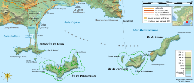
Français : Carte topographique et administrative en français des Îles d'Hyères.
Deutsch: Topographische Karte / Verwaltungskarte zum Îles d'Hyères, in Französische
English: Topographic and administrative map in French language of Îles d'Hyères
Italiano: Carta topografica e amministrativa delle Isole di Hyères (en francese)
|
||
| Dato | (UTC) | ||
| Kjelde |
Création personnelle ;
|
||
| Opphavsperson | Bourrichon (talk) - fr:Bourrichon | ||
| Løyve (Gjenbruk av denne fila) |
|
||
| Andre versjonar |
Add-your-version : Template:Other versions/Îles d'Hyères map
|


|
Denne SVG-fila inneheld tekst som kan setjast om til ditt språk. Det kan gjerast med eit kvart program som kan endra SVG-filer, tekst eller med SVG-omsetjingsverktøyet. For meir informasjon, sjå hjelpesida for omsetjing av SVG-filer. |
Vektorgrafikken vart laga med Inkscape .
Lisensiering:
Eg, opphavsrettshaldaren til verket, publiserer det hermed under desse lisensane:

|
Det er tillate å kopiera, distribuera og/eller modifisera dette dokumentet under retningslinene som er skildra i GNU fri dokumentasjonslisens, versjon 1.2 eller seinare utgåve utgjeven av Free Software Foundation; med alle seksjonane, utan nokon framsidetekstar og baksidetekstar. Ein kopi av lisensen er inkludert i avsnittet GNU Free Documentation License. |
Denne filen er lisensiert under lisensene Creative Commons Navngivelse-DelPåSammeVilkår 3.0 Unported, 2.5 Generisk, 2.0 Generisk og 1.0 Generisk.
- Du står fritt til å:
- til å dela – til å kopiera, distibuera og overføra arbeidet
- til å blanda – til å endra verket
- På desse vilkåra:
- namngjeving – Du lyt godskriva verket på den måten som opphavpersonen eller lisensgjevaren har oppgjeve (men ikkje på ein slik måte at det kan verka som om dei går god for deg eller måten du nyttar verket på).
- del på same vilkåra – Om du remiksar, omarbeider, eller på annan måte byggjer på dette verket, kan du berre distribuera resultatet under den same eller ein samsvarande lisens som denne.
Du kan velje den lisensen du sjølv tykkjer er best.
Filhistorikk
Klikk på dato/klokkeslett for å sjå fila slik ho var på det tidspunktet.
| Dato/klokkeslett | Miniatyrbilete | Oppløysing | Brukar | Kommentar | |
|---|---|---|---|---|---|
| gjeldande | 23. august 2018 kl. 13:40 | | 784 × 337 (1,84 MB) | Bourrichon | +extension des limites du parc national : ajout de l'île de Porquerolles |
| 19. august 2011 kl. 15:53 |  | 784 × 337 (1,83 MB) | Bourrichon | == {{int:filedesc}} == {{Location|20|15|00|S|57|35|00|E|scale:500000}} {{Information |Description= {{fr|Carte topographique et administrative en français des Îles d'Hyères.}} {{de|Topographische Karte / Verwaltungskarte zum [[: |
Filbruk
Den følgjande sida bruker denne fila:
Global filbruk
Desse andre wikiane nyttar fila:
- Bruk på cs.wikipedia.org
- Bruk på da.wikipedia.org
- Bruk på de.wikipedia.org
- Bruk på en.wikipedia.org
- Bruk på en.wikivoyage.org
- Bruk på fr.wikipedia.org
- Conservatoire du littoral
- Parc national de Port-Cros
- Presqu'île de Giens
- Îles d'Hyères
- Utilisateur:Flappiefh/Bac à sable/Images à améliorer/Contenu visiteur
- Wikipédia:Atelier graphique/Cartes/Archives/septembre 2011
- Rade d'Hyères
- Wikipédia:Atelier graphique/Cartes/Archives/octobre 2016
- Golfe de Giens
- Bruk på fr.wiktionary.org
- Bruk på ja.wikipedia.org
- Bruk på la.wikipedia.org
- Bruk på oc.wikipedia.org
- Bruk på pl.wikipedia.org
- Bruk på pt.wikipedia.org
- Bruk på ru.wikipedia.org
- Bruk på www.wikidata.org
- Bruk på zh.wikipedia.org
- Bruk på zh.wikivoyage.org