
Fil:Map of Alaska highlighting Nome Census Area.svg

Storleik på denne PNG-førehandsvisinga av denne SVG-fila: 800 × 423 pikslar. Andre oppløysingar: 320 × 169 pikslar | 640 × 338 pikslar | 1 024 × 541 pikslar | 1 280 × 677 pikslar | 2 560 × 1 353 pikslar | 1 470 × 777 pikslar.
Opphavleg fil (SVG-fil, standardoppløysing: 1 470 × 777 pikslar, filstorleik: 338 KB)
Følgjande er henta frå filomtalen åt denne fila på Wikimedia Commons:
Skildring
| Skildring |
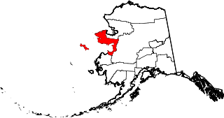
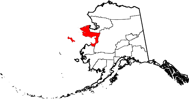
English: This is a locator map showing Nome Census Area in Alaska |
| Dato | |
| Kjelde |
Eige arbeid: English: The maps use data from nationalatlas.gov, specifically countyp020.tar.gz on the Raw Data Download page. The maps also use state outline data from statesp020.tar.gz. The Florida maps use hydrogm020.tar.gz to display Lake Okeechobee. |
| Opphavsperson | David Benbennick |
Lisensiering:
| Eg, opphavsrettshaldaren til dette verket, frigjev dette verket til ålmenta. Dette gjeld over heile verda. I somme landa er dette kan henda ikkje rettsleg mogeleg. I det fall: Eg gjev kven som helst rettane til å nytta dette verket for kva som helst føremål og utan vilkår, minder vilkår er kravde etter lova. |
Filhistorikk
Klikk på dato/klokkeslett for å sjå fila slik ho var på det tidspunktet.
| Dato/klokkeslett | Miniatyrbilete | Oppløysing | Brukar | Kommentar | |
|---|---|---|---|---|---|
| gjeldande | 5. mars 2006 kl. 21:28 | | 1 470 × 777 (338 KB) | David Benbennick | {{subst:User:Dbenbenn/clm|county=Nome Census Area|state=Alaska|type=borough and census area}} |
Filbruk
Den følgjande sida bruker denne fila:
Global filbruk
Desse andre wikiane nyttar fila:
- Bruk på az.wikipedia.org
- Bruk på bpy.wikipedia.org
- Bruk på ca.wikipedia.org
- Brevig Mission
- Diomede
- Elim (Alaska)
- Gambell
- Golovin
- Koyuk
- Nome (Alaska)
- Port Clarence
- Savoonga
- Shaktoolik
- Shishmaref
- St. Michael (Alaska)
- Stebbins
- Teller (Alaska)
- Unalakleet
- Wales (Alaska)
- White Mountain
- Llista de boroughs i àrees censals d'Alaska
- Plantilla:Àrea censal de Nome
- Categoria:Àrea censal de Nome
- Bruk på ce.wikipedia.org
- Bruk på cy.wikipedia.org
- Bruk på de.wikipedia.org
- Bruk på en.wikipedia.org
- List of boroughs and census areas in Alaska
- Nome Census Area, Alaska
- Brevig Mission, Alaska
- Diomede, Alaska
- Elim, Alaska
- Gambell, Alaska
- Golovin, Alaska
- Koyuk, Alaska
- Nome, Alaska
- Port Clarence, Alaska
- Savoonga, Alaska
- Shaktoolik, Alaska
- Shishmaref, Alaska
- St. Michael, Alaska
- Stebbins, Alaska
- Teller, Alaska
- Unalakleet, Alaska
- Wales, Alaska
- White Mountain, Alaska
- Iñupiat
- Cape Prince of Wales
- Norton Sound
- Council, Alaska
- Mary's Igloo, Alaska
Sjå meir global bruk av denne fila.