
Fil:West Midlands UK location map.svg

Storleik på denne PNG-førehandsvisinga av denne SVG-fila: 800 × 547 pikslar. Andre oppløysingar: 320 × 219 pikslar | 640 × 437 pikslar | 1 024 × 700 pikslar | 1 280 × 875 pikslar | 2 560 × 1 750 pikslar | 1 425 × 974 pikslar.
Opphavleg fil (SVG-fil, standardoppløysing: 1 425 × 974 pikslar, filstorleik: 1,35 MB)
Følgjande er henta frå filomtalen åt denne fila på Wikimedia Commons:
| Skildring |
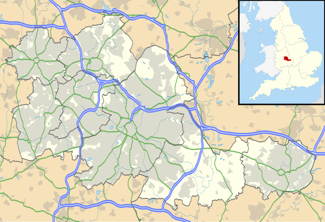
Map of the West Midlands, UK with the following information shown:
Equirectangular map projection on WGS 84 datum, with N/S stretched 160% Geographic limits:
|
| Dato | |
| Kjelde |
|
| Opphavsperson | Nilfanion, created using Ordnance Survey data |
| Løyve (Gjenbruk av denne fila) |
Denne fila er lisensiert under lisensen Creative Commons Namngjeving-DelPåSameVilkåra 3.0 Unported Namngjeving: Contains Ordnance Survey data © Crown copyright and database right
|
| Andre versjonar | File:West Midlands UK district map (blank).svg - Blank map |
.svg)
Filhistorikk
Klikk på dato/klokkeslett for å sjå fila slik ho var på det tidspunktet.
| Dato/klokkeslett | Miniatyrbilete | Oppløysing | Brukar | Kommentar | |
|---|---|---|---|---|---|
| gjeldande | 26. september 2010 kl. 21:17 | | 1 425 × 974 (1,35 MB) | Nilfanion | {{Information |Description=Map of the West Midlands, UK with the following information shown: *Administrative borders *Coastline, lakes and rivers *Roads and railways *Urban areas Equirectangular map projection on WGS 84 datu |
Filbruk
Den følgjande sida bruker denne fila:
Global filbruk
Desse andre wikiane nyttar fila:
- Bruk på ar.wikipedia.org
- Bruk på ast.wikipedia.org
- Bruk på bg.wikipedia.org
- Bruk på ceb.wikipedia.org
- Bruk på en.wikipedia.org
- Moseley
- Moseley and Kings Heath (ward)
- Coventry Cathedral
- Coventry Transport Museum
- 2002–03 FA Premier League
- 2003–04 FA Premier League
- Walsall
- West Bromwich
- Dudley
- Tipton
- Birmingham Airport
- Soho House
- Aston
- Smethwick
- Oldbury, West Midlands
- Rowley Regis
- Birmingham Town Hall
- Birmingham Museum and Art Gallery
- Aldridge
- Sutton Coldfield
- Bilston
- Sutton Park, West Midlands
- Blackheath, West Midlands
- Black Country Living Museum
- Dudley Castle
- Willenhall
- Halesowen
- Knowle, West Midlands
- Stourbridge
- Brierley Hill
- Brownhills
- Hampton in Arden
- Spaghetti Junction, Birmingham
- Edgbaston
- Sedgley
- Harborne
- Soho, West Midlands
- Birmingham Botanical Gardens, England
- 2004–05 FA Premier League
- Thinktank, Birmingham Science Museum
- Bournville
- Hall Green
- Northfield, Birmingham
Sjå meir global bruk av denne fila.