
Fil:Trigonometrical Plan of the Island and Harbour of Bahrain.jpg
Storleik på førehandsvising: 529 × 599 pikslar. Andre oppløysingar: 212 × 240 pikslar | 424 × 480 pikslar | 678 × 768 pikslar | 904 × 1 024 pikslar | 2 098 × 2 376 pikslar.
Opphavleg fil (2 098 × 2 376 pikslar, filstorleik: 1,8 MB, MIME-type: image/jpeg)
Følgjande er henta frå filomtalen åt denne fila på Wikimedia Commons:
Skildring
| Skildring |
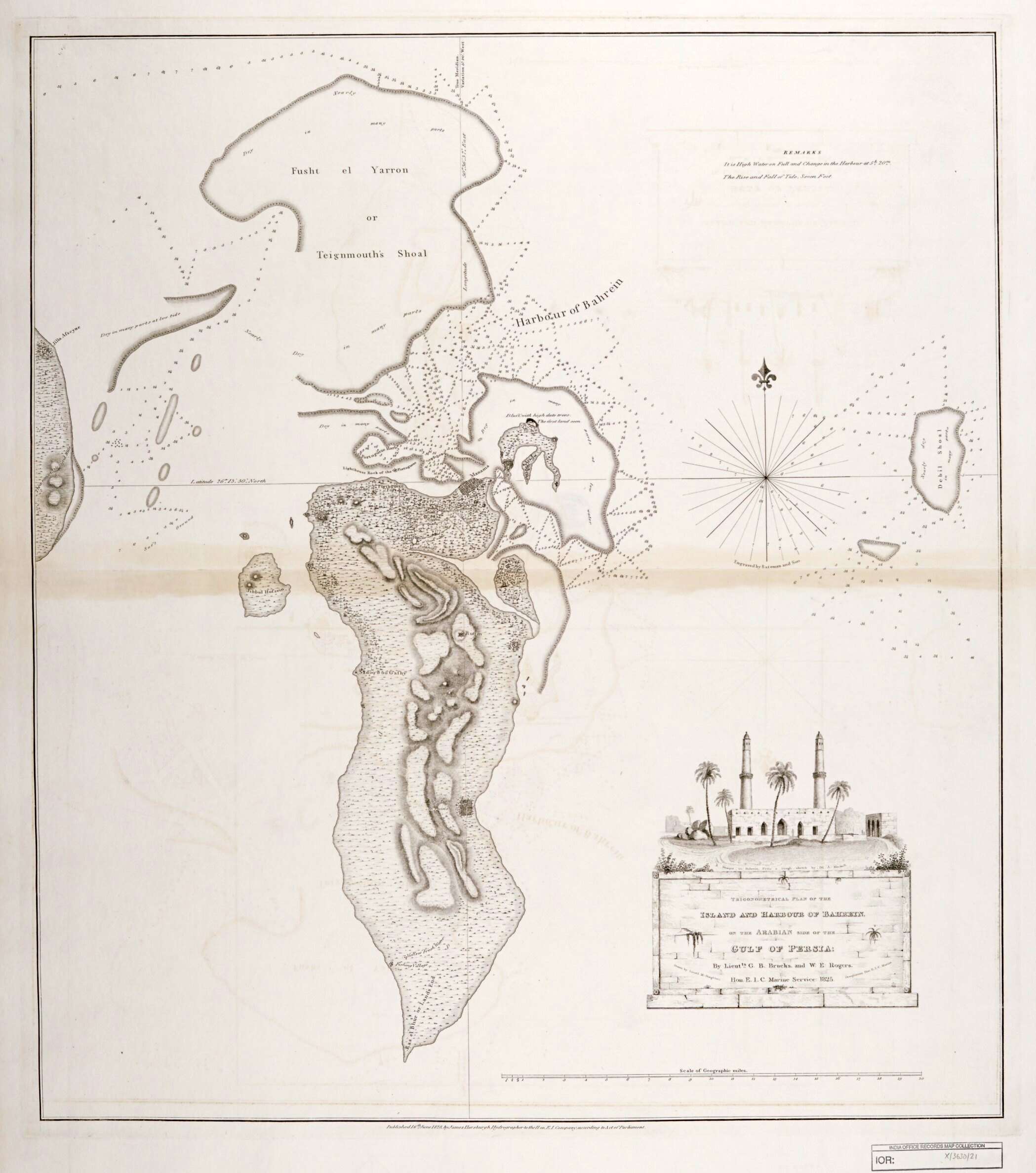
English: "‘Trigonometrical Plan of the Island and Harbour of Bahrein, on the Arabian Side of the Gulf of Persia; by Lieutts. G.B. Brucks, and W.E. Rogers. Hon. E.I.C. Marine Service: 1825. Drawn by Lieutt. M. Houghton; Draughtsman Hon. E.I.C. Marine. Engraved by Bateman and Son’" |
| Dato | |
| Kjelde | Qatar Digital Library |
| Opphavsperson | by Lieutts. G.B. Brucks, and W.E. Rogers. Hon. E.I.C. Marine Service: 1825. Drawn by Lieutt. M. Houghton; Draughtsman Hon. E.I.C. Marine |
| Andre versjonar |

Lisensiering:
_(St_Edwards_Crown).svg)
|
This file is licensed under the Open Government Licence version 1.0 (OGL v1.0).
|
|---|---|
| Namngjeving:1 | |
|
You are free to:
See the Open Government Licence page on Meta-Wiki for more information.
|
Filhistorikk
Klikk på dato/klokkeslett for å sjå fila slik ho var på det tidspunktet.
| Dato/klokkeslett | Miniatyrbilete | Oppløysing | Brukar | Kommentar | |
|---|---|---|---|---|---|
| gjeldande | 11. januar 2019 kl. 02:40 | | 2 098 × 2 376 (1,8 MB) | Elspamo4 | Cropped, adjusted contrast |
| 11. januar 2019 kl. 02:38 |  | 2 370 × 3 000 (665 KB) | Elspamo4 | User created page with UploadWizard |
Filbruk
Det finst ikkje noka side som bruker denne fila.
Global filbruk
Desse andre wikiane nyttar fila:
- Bruk på en.wikipedia.org
- Bruk på fa.wikipedia.org