
Fil:IssaouaneErg Algeria ISS010-E-13539.jpg
Opphavleg fil (1 000 × 662 pikslar, filstorleik: 491 KB, MIME-type: image/jpeg)
Følgjande er henta frå filomtalen åt denne fila på Wikimedia Commons:
Skildring
| Skildring |
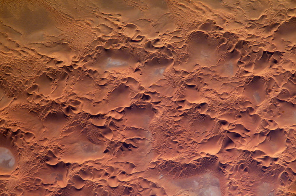
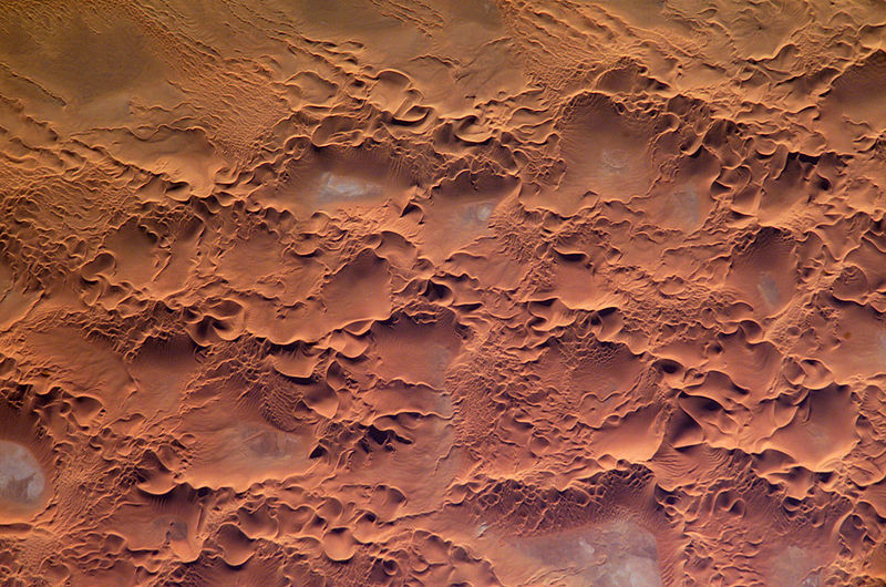
English: Astronaut photo of the Issaouane Erg (Sahara Desert), Algeria.
|
||||||||||||||||||||||||||||||||||||||||||||||||||||||
| Dato | |||||||||||||||||||||||||||||||||||||||||||||||||||||||
| Kjelde | http://earthobservatory.nasa.gov/Newsroom/NewImages/images.php3?img_id=16813 | ||||||||||||||||||||||||||||||||||||||||||||||||||||||
| Opphavsperson | ISS Crew Earth Observations experiment and the Image Science & Analysis Group, Johnson Space Center. | ||||||||||||||||||||||||||||||||||||||||||||||||||||||
| Løyve (Gjenbruk av denne fila) |
NASA, public domain | ||||||||||||||||||||||||||||||||||||||||||||||||||||||
Lisensiering:
This file is in the public domain in the United States because it was created by the Image Science & Analysis Laboratory, of the NASA Johnson Space Center. NASA copyright policy states that "NASA material is not protected by copyright unless noted". (NASA media use guidelines or Conditions of Use of Astronaut Photographs).
Photo source: ISS010-E-13539.
|
Filhistorikk
Klikk på dato/klokkeslett for å sjå fila slik ho var på det tidspunktet.
| Dato/klokkeslett | Miniatyrbilete | Oppløysing | Brukar | Kommentar | |
|---|---|---|---|---|---|
| gjeldande | 18. mai 2006 kl. 19:58 | | 1 000 × 662 (491 KB) | Holly Cheng | ==Summary== {{Information | Description=Astronaut photo of the Issaouane Erg (Sahara Desert), Algeria. | Source=http://earthobservatory.nasa.gov/Newsroom/NewImages/images.php3?img_id=16813 | Date=January 16, 2005 | Author=ISS Crew Earth Observations exper |
Filbruk
Den følgjande sida bruker denne fila:
Global filbruk
Desse andre wikiane nyttar fila:
- Bruk på ar.wikipedia.org
- Bruk på ba.wikipedia.org
- Bruk på be.wikipedia.org
- Bruk på bg.wikipedia.org
- Bruk på br.wikipedia.org
- Bruk på ceb.wikipedia.org
- Bruk på da.wikipedia.org
- Bruk på de.wikipedia.org
- Bruk på en.wikipedia.org
- Bruk på eo.wikipedia.org
- Bruk på fi.wikipedia.org
- Bruk på fr.wikipedia.org
- Bruk på fr.wiktionary.org
- Bruk på hi.wikipedia.org
- Bruk på it.wikipedia.org
- Bruk på it.wikibooks.org
- Bruk på ka.wikipedia.org
- Bruk på lt.wikipedia.org
- Bruk på mhr.wikipedia.org
- Bruk på mk.wikipedia.org
- Bruk på pl.wikipedia.org
- Bruk på pl.wiktionary.org
- Bruk på ro.wikipedia.org
- Bruk på ru.wikipedia.org
- Bruk på sl.wikipedia.org
- Bruk på sr.wikipedia.org
- Bruk på sv.wikipedia.org
- Bruk på sv.wiktionary.org
- Bruk på uk.wikipedia.org
- Bruk på uz.wikipedia.org
- Bruk på vi.wikipedia.org
- Bruk på www.wikidata.org