Corinth Head
| Corinth Head | |||
| nes | |||
| Land | |||
|---|---|---|---|
| Stad | Heard- og McDonaldøyane | ||
| - koordinatar | 53°1′S 73°25′E / 53.017°S 73.417°E | ||
| Administrert under | Antarktistraktaten | ||
 Corinth Head 53°01′00″S 73°25′00″E / 53.0167°S 73.4167°E | |||
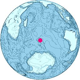
Corinth Head er eit klipperikt nes 0,5 nautiske mil søraust for Rogers Head, på vestsida av Corinthian Bay og på nordsida av Heardøya. Neset vart først grovt kartlagd av Den første tyske antarktisekspedisjonen under Erich von Drygalski, som kartla øya i fart nordsida av øya i 1902. Det vart kartlagd på ny av Australian National Antarctic Research Expeditions i 1948, og ho fekk dette namnet av dei fordi det låg nær Corinthian Bay.[1]
Kjelder[endre | endre wikiteksten]
- ↑ «Corinth Head». Geographic Names Information System. United States Geological Survey, United States Department of the Interior. Henta 27. desember 2012.
![]() Denne artikkelen inneheld stoff som er offentleg eige frå United States Geological Survey-artikkelen «Corinth Head» (innhald frå Geographic Names Information System).
Denne artikkelen inneheld stoff som er offentleg eige frå United States Geological Survey-artikkelen «Corinth Head» (innhald frå Geographic Names Information System).

