
Fil:Loch Lomond and The Trossachs National Park UK relief location map.png

Storleik på førehandsvising: 685 × 600 pikslar. Andre oppløysingar: 274 × 240 pikslar | 548 × 480 pikslar | 877 × 768 pikslar | 1 170 × 1 024 pikslar | 2 001 × 1 752 pikslar.
Opphavleg fil (2 001 × 1 752 pikslar, filstorleik: 3,58 MB, MIME-type: image/png)
Følgjande er henta frå filomtalen åt denne fila på Wikimedia Commons:
| Skildring |
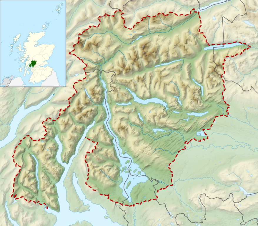
Relief map of the Loch Lomond and The Trossachs National Park, UK Equirectangular map projection on WGS 84 datum, with N/S stretched 170% Geographic limits:
|
| Dato | |
| Kjelde |
Office of National Statistics Geography
|
| Opphavsperson | Nilfanion, created using Ordnance Survey data |
| Løyve (Gjenbruk av denne fila) |
Denne fila er lisensiert under lisensen Creative Commons Namngjeving-DelPåSameVilkåra 3.0 Unported Namngjeving: Contains Ordnance Survey data © Crown copyright and database right
|
Filhistorikk
Klikk på dato/klokkeslett for å sjå fila slik ho var på det tidspunktet.
| Dato/klokkeslett | Miniatyrbilete | Oppløysing | Brukar | Kommentar | |
|---|---|---|---|---|---|
| gjeldande | 17. mars 2012 kl. 12:52 | | 2 001 × 1 752 (3,58 MB) | Nilfanion | {{Information |Description=Relief map of the Loch Lomond and The Trossachs National Park, UK Equirectangular map projection on WGS 84 datum, with N/S stretched 170% Geographic limits: *West: 5.15W *Ea... |
Filbruk
Den følgjande sida bruker denne fila:
Global filbruk
Desse andre wikiane nyttar fila:
- Bruk på da.wikipedia.org
- Bruk på en.wikipedia.org
- Bruk på fi.wikipedia.org
- Bruk på fr.wikipedia.org
- Bruk på is.wikipedia.org
- Bruk på it.wikipedia.org
- Bruk på nl.wikipedia.org
- Bruk på no.wikipedia.org
- Bruk på ru.wikipedia.org
- Bruk på sl.wikipedia.org
- Bruk på zh.wikipedia.org