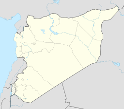
Qarah i Syria
| Qarah | |||
| قارة, Qārā, Karah | |||
| by | |||
| Land | |||
|---|---|---|---|
| Guvernement | Rif Dimashq guvernement | ||
| Distrikt | Al-Nabk-distriktet | ||
| Høgd | 1 280 moh. | ||
| Koordinatar | 34°09′15″N 36°44′39″E / 34.15417°N 36.74417°E | ||
| Folketal | 12 508 (2004) | ||
 Qarah i Syria 34°09′15″N 36°44′39″E / 34.15416667°N 36.74416667°E | |||
Qarah eller Karah (arabisk قارة) er ein by i Syria i Qalamoun-distriktet i Rif Dimashq guvernement. Han ligg mellom Qalamounfjella og Anti-Libanonfjella, 95 km nord for hovudstaden Damaskus langs vegen til byen Homs. Innbyggjarane er hovudsakleg sunnimuslimar og gresk-ortodokse og katolikkar kristne.[1]
Historie[endre | endre wikiteksten]
Han var den sørlegaste byen i Jund Hims militærdistrikt i Stor-Syria under Umayyade-kalifatet.[2] Abu'l-Fida skildra byen i hans Geografi av 1321 som «ein stor landsby halvvegs mellom Damaskus og Homs. Han er ein stoppestad for karavanane. Dei fleste innbyggjarane er kristne. Han ligg 1½ marsjar frå Homs og 2 marsjar frå Damaskus.»[3] Sidan1300-talet har Qarah lege i skuggen til nabobyen An Nabk i sør.
Kjelder[endre | endre wikiteksten]
- Denne artikkelen bygger på «Qarah, Syria» frå Wikipedia på engelsk, den 3. juli 2014.
- Wikipedia på engelsk oppgav desse kjeldene:
- Smith, Eli; Robinson, Edward (1841). Biblical Researches in Palestine, Mount Sinai and Arabia Petraea: A Journal of Travels in the Year 1838 3. Crocker and Brewster.
- ↑ Smith, 1841, s. 173.
- ↑ Yaqut al-Hamawi som sitert i le Strange, Guy (1890). Palestine Under the Moslems: A Description of Syria and the Holy Land from A.D. 650 to 1500. London: Aleksander P. Watt for the Committee of the Palestine Exploration Fund. s. 36. OCLC 1004386. Henta 23. juni 2014.
- ↑ Quoted at le Strange, Guy (1890). Palestine Under the Moslems: A Description of Syria and the Holy Land from A.D. 650 to 1500. London: Aleksander P. Watt for the Committee of the Palestine Exploration Fund. s. 478. OCLC 1004386. Henta 23. juni 2014.
Bakgrunnsstoff[endre | endre wikiteksten]
- «Photograph of Qarah street" Flickr.com


