Grass Island i Sør-Georgia
| Grass Island | |||
| øy | |||
| Land | |||
|---|---|---|---|
| Øygruppe | Sør-Georgia | ||
| Del av | Sør-Georgia | ||
| Koordinatar | 54°9′S 36°40′W / 54.150°S 36.667°W | ||
| Areal | 0,26 km² | ||
| Folketal | 0 | ||
| Administrert under | = | ||
 Grass Island i Sør-Georgia 54°09′00″S 36°40′00″W / 54.15°S 36.6667°W | |||
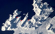
Grass Island er ei lett synleg øy i innløpet til Strømnes i Strømnesfjorden i Sør-Georgia. Ho vart kalla «Mutton Island» så tidleg som 1912, men etter 1920 har namnet Grass Island vore i bruk.[1]
Den 22. og 23. april 1982, etter at ei britisk spesialbåtteneste vart driven attende av snø i Cumberland East Bay, gjekk Special Air Service i land på Grass Island frå HMS «Antrim», og gjekk til åtak på argentinske stillingar frå her.[2]
I 2000 vart øya fri for rotter etter at eit team frå New Zealand var med på utryddinga.
Sjå òg[endre | endre wikiteksten]
- Composite Antarctic Gazetteer
- Antarktiske øyar nord for 60 °S
- Scientific Committee on Antarctic Research
Kjelder[endre | endre wikiteksten]
- ↑ «Grass Island». Geographic Names Information System. United States Geological Survey, United States Department of the Interior. Henta 22. oktober 2012.
- ↑ Bicheno, Hugh (2006) Razor's Edge: The Unofficial History av Falklandskrigen. London. Weidenfield & Nicholson. ISBN 978-0-7538-2186-2
![]() Denne artikkelen inneheld stoff som er offentleg eige frå United States Geological Survey-artikkelen «Grass Island» (innhald frå Geographic Names Information System).
Denne artikkelen inneheld stoff som er offentleg eige frå United States Geological Survey-artikkelen «Grass Island» (innhald frå Geographic Names Information System).


