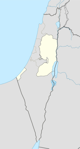
Deir Abu Mash'al
| Deir Abu Mash'al | |||
| دير ابو مشعل | |||
| kommune | |||
Deir Abu Mash'al
| |||
| Land | |||
|---|---|---|---|
| Guvernement | Ramallah og al-Bireh guvernement | ||
| Koordinatar | 31°59′54.05″N 35°04′06.10″E / 31.9983472°N 35.0683611°E | ||
| Folketal | 3 522 (2007) | ||
| Borgarmeister | Ibrahim Mohammad Yousi Zhran[1] | ||
 Deir Abu Mash'al 31°59′54″N 35°04′06″E / 31.998347222222°N 35.068361111111°E | |||
| Wikimedia Commons: Deir Abu Mash'al | |||
Deir Abu Mash'al (arabisk دير ابو مشعل) er ein palestinsk landsby i Ramallah og al-Bireh guvernement, 24 km vest for Ramallah, nord på Vestbreidda. I følgje Palestinsk statistisk sentralbyrå (PCBS) hadde landsbyen eit folketal på kring 3 522 innbyggjarar i 2007.[2]
Kjelder[endre | endre wikiteksten]
- Denne artikkelen bygger på «Deir Abu Mash'al» frå Wikipedia på engelsk, den 22. september 2015.
- Wikipedia på engelsk oppgav desse kjeldene:
- ↑ Vestbreidda Local Elections ( Round two)- Successful candidates by local authority, gender and No. of votes obtained, Deir Abu Mish'al p 22
- ↑ 2007 PCBS Census. Palestinsk statistisk sentralbyrå. s.113.


