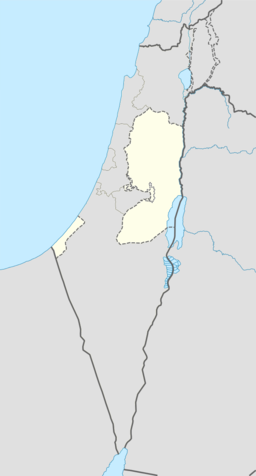
'Atara
| 'Atara | |||
| عطارة, Attara, Ataroth | |||
| kommune | |||
'Atara
| |||
| Namneopphav: Attara, Ataroth[1] | |||
| Land | |||
|---|---|---|---|
| Guvernement | Ramallah og al-Bireh guvernement | ||
| Koordinatar | 32°00′09″N 35°12′23″E / 32.00250°N 35.20639°E | ||
| Areal | 9,5 km² | ||
| Folketal | 2 270 (2007) | ||
| Folketettleik | 239 / km² | ||
 'Atara 32°00′09″N 35°12′23″E / 32.0025°N 35.206388888889°E | |||
| Wikimedia Commons: Atara | |||
Atara (arabisk عطارة ′Atâra) er ein palestinsk landsby i Ramallah og al-Bireh guvernement, 15 kilometer nord for Ramallah sentralt på Vestbreidda. Han er ein landsby med nesten 2 300 innbyggjarar, og ligg langs ein fjellrygg med fire toppar, oger bygd på det nest høgaste punktet på Vestbreidda, 810 meter over havet.[2][3]
Av stader i nærleiken finn ein Jifna i sør, Bir Zeit i sørvest, Kobar i vest, Rawabi og Ajjul i nordvest, Abwein i nord, Sinjil i nordaust og al-Mazra'a ash-Sharqiya i aust.[4]
Historie[endre | endre wikiteksten]
Edward Robinson identifiserte 'Atara som den bibelske staden Ataroth, som er nemnt i Josvas bok.[5] Men moderne forskarar meiner at Ataroth låg andre stader.[6][7]
I 1596 stod Atara oppført i osmanske skattelister som ein del av Quds nahiya i Quds liwa. Han hadde eit folketal på 55 muslimske hushaldningar og betalte skatt for kveite, bygg, oliven, vindruer eller frukttre, og geiter eller bikubar.[8]
Den franske oppdagaren Victor Guérin vitja landsbyen seint på 1800-talet, og estimerte at han hadde kring 300 innbyggjarar.[9] I 1882 skildra Palestine Exploration Fund i Survey of Western Palestine Attara som ein stor landsby, tilsynelatande særs gammal, på ei høgd, med oliven rundt.[10]
Under folketeljinga i Palestina i 1922 hadde Atara eit folketal på 407 muslimar.[11] I folketeljinga i 1931 hadde dette auka til 559 muslimar i 133 busette hus.[12] I 1945 var det 690 innbyggjarar i landsbyen.[13]
Kjelder[endre | endre wikiteksten]
- Denne artikkelen bygger på «'Atara» frå Wikipedia på engelsk, den 22. september 2015.
- Wikipedia på engelsk oppgav desse kjeldene:
- Conder, Claude Reignier; Kitchener, Herbert H. (1882). The Survey of Western Palestine: Memoirs of the Topography, Orography, Hydrography, and Archeology 2. London: Committee of the Palestine Exploration Fund.
- Guérin, Victor (1875). Description Géographique, Historique et Archéologique de la Palestine. Vo 2, s. 2: Samarie.
- Hadawi, Sami (1970), Village Statistics of 1945: A Classification of Land and Area ownership in Palestine, Palestinsk frigjeringsorganisasjon forskingssentral
- E. Mills, red. (1932). Census of Palestine 1931. Population of Villages, Towns and Administrative Areas (PDF). Jerusalem: Government of Palestine.
- Singer, Amy. (1994). Palestinian Peasants and Ottoman Officials: Rural Administration Around Sixteenth-Century Jerusalem Cambridge University Press. ISBN 0-521-47679-8.
- Palmer, E. H. (1881). The Survey of Western Palestine: Arabic and English Name Lists Collected During the Survey by Lieutenants Conder og Kitchener, R. E. Transliterated and Explained by E.H. Palmer. Committee of the Palestine Exploration Fund.
- ↑ Palmer, 1881, s. 225
- ↑ The Struggles of a Palestinian Community due to the West Bank Closure Arkivert 2005-12-22 ved Wayback Machine. Applied Research Institute - Jerusalem. 2001-02-02.
- ↑ 'Atara The Palestinian Association of Cultural Exchange
- ↑ Satellite view of 'Atara
- ↑ Robinson, Edward and Eli Smith Biblical Researches in Palestine and Adjacent Regions: A Journal of Travels in the Year 1838 Crocker and Brewster, s.256.
- ↑ Yoram Tsafrir, Leah Di Segni and Judith Green (1994). Tabula Imperii romerski: Judea, Palaestina. Jerusalem: Israel Academy of Sciences and Humanities. s. 71.
- ↑ Adam Zertal, Dror Ben-Yosef, Oren Cohen and Ron Be'eri (2009). «Kh. 'Aujah el-Foqa (Ataroth) — an jernalderen Fortified City i Jordandalen». Palestina Exploration Quarterly 141: 104–123. doi:10.1179/174313009x437819.
- ↑ Wolf-Dieter Hütteroth and Kamal Abdulfattah (1977). Historical Geography of Palestine, Transjordan and South Syria in the Late 16th Century. Erlanger Geographische Arbeiten, Sonderband 5. Erlangen, Tyskland: Vorstand der Fränkischen Geographischen Gesellschaft. s. 114.
- ↑ Guérin, 1875, s. 169
- ↑ Conder og Kitchener, 1882, s. 289
- ↑ J. B. Barron, red. (1923). Palestine: Report and General Abstracts of the Census of 1922. Government of Palestine. Table VII.
- ↑ E. Mills, red. (1932). Census of Palestine 1931. Population of Villages, Towns and Administrative Areas. Jerusalem: Government of Palestine. s. 47.
- ↑ Hadawi, Sami. (1970). Ramallah distrikt Statistics s.64.


