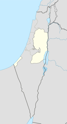
Beit Sahour
| Beit Sahour | |||
| بيت ساحور, Beit Sahur, Bayt Sahoor | |||
| kommune | |||
Beit Sahour
| |||
| Namneopphav: Nattevakt-huset | |||
| Land | |||
|---|---|---|---|
| Guvernement | Betlehem guvernement | ||
| Koordinatar | 31°42′N 35°13′E / 31.700°N 35.217°E | ||
| Areal | 6,9 km² | ||
| Folketal | 12 367 (2007) | ||
| Folketettleik | 1 792 / km² | ||
 Beit Sahour 31°42′00″N 35°13′00″E / 31.7°N 35.216666666667°E | |||
| Wikimedia Commons: Beit Sahour | |||
| Nettstad: Beit Sahour Municipality | |||
Beit Sahour (arabisk بيت ساحور) er ein palestinsk by aust for Betlehem i Den palestinske sjølvstyresmakta. Folketalet er 12 367,[1] der 80 % er kristne (dei fleste gresk-ortodokse) og 20 % muslimar.[2]
Historie[endre | endre wikiteksten]
I 1596 stod Beit Sahour oppført i osmanske skattelister som to landsbyar i Quds nahiyah i Quds liwa. Beit Sahour an-Nasara eit folketal på 15 muslimske hushaldningar og 9 ungkarar. Beit Sahour al-Wadi (identifisert som Beit Sahour al-Atiqa[3]) hadde eit folketal på 40 muslimske hushaldningar. Dei to landsbane betalte skatt for kveite, bygg, vindruer eller frukttre, og geiter eller bikubar.[4]
Kjelder[endre | endre wikiteksten]
- Denne artikkelen bygger på «Beit Sahour» frå Wikipedia på engelsk, den 1. oktober 2015.
- Wikipedia på engelsk oppgav desse kjeldene:
- ↑ 2007 PCBS Census Palestinsk statistisk sentralbyrå. s.117.
- ↑ History, Economy, and Tourism[daud lenkje] Beit Sahour Municipality.
- ↑ Charles Clermont-Ganneau (1899). Archaeological Researches in Palestina during the years 1873–1874 1. London: Palestine Exploration Fund. s. 435.
- ↑ Wolf-Dieter Hütteroth and Kamal Abdulfattah (1977). Historical Geography of Palestine, Transjordan and South Syria in the Late 16th Century. Erlanger Geographische Arbeiten, Sonderband 5. Erlangen, Tyskland: Vorstand der Fränkischen Geographischen Gesellschaft. s. 115, 119.
Bakgrunnsstoff[endre | endre wikiteksten]
- Beit Sahour kommune Arkivert 2013-12-20 ved Wayback Machine.


